MyTopo
Yates City Illinois US Topo Map
Couldn't load pickup availability
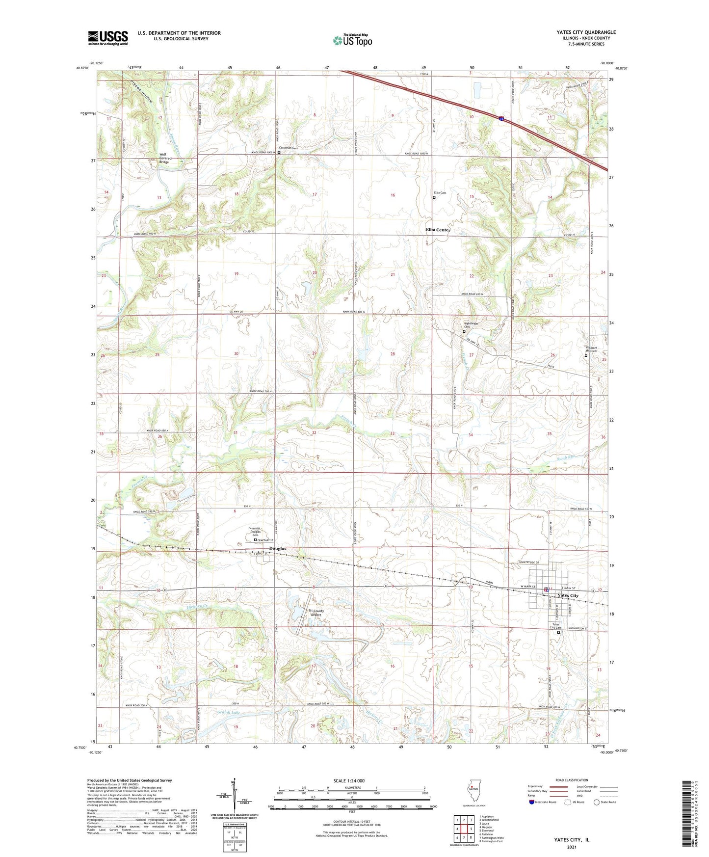
2024 topographic map quadrangle Yates City in the state of Illinois. Scale: 1:24000. Based on the newly updated USGS 7.5' US Topo map series, this map is in the following counties: Knox. The map contains contour data, water features, and other items you are used to seeing on USGS maps, but also has updated roads and other features. This is the next generation of topographic maps. Printed on high-quality waterproof paper with UV fade-resistant inks.
Quads adjacent to this one:
West: Maquon
Northwest: Appleton
North: Williamsfield
Northeast: Laura
East: Elmwood
Southeast: Farmington East
South: Farmington West
Southwest: Fairview
This map covers the same area as the classic USGS quad with code o40090g1.
Contains the following named places: Catterton Cemetery, Cedar Bluff School, Corey School, Douglas, Elba - Salem Fire Protection District, Elba Cemetery, Elba Center, Elba Chapel, Elba School, Faith Camp, Faith United Presbyterian Church, Ford School, Foster School, Grandt Lake, Kightlinger Cemetery, McGirr School, Pigeon Hollow, Pleasant Grove School, Pleasant Hill Cemetery, Pleasant Hill School, Salem Center School, Summitt - Douglas Cemetery, Swab Run, Township of Elba, Township of Salem, Tri-County Airport, Union School, Village of Yates City, West Union School, Wolf Covered Bridge, Yates City, Yates City Cemetery, Yates City Community Center, Yates City Grade School, Yates City Police Department, Yates City Post Office, ZIP Code: 61572