MyTopo
Fiatt Illinois US Topo Map
Couldn't load pickup availability
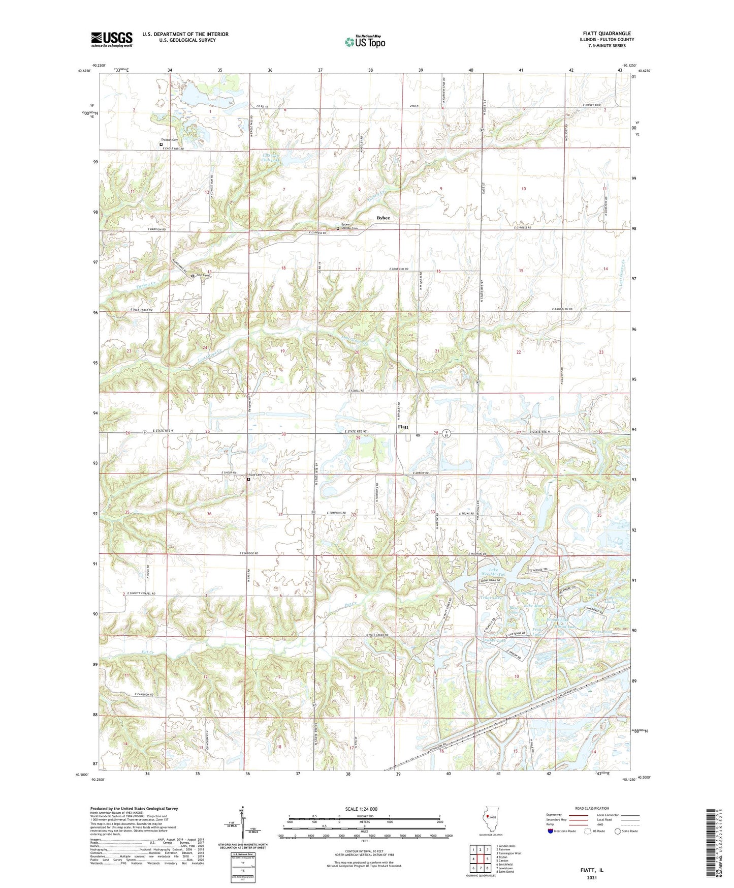
2024 topographic map quadrangle Fiatt in the state of Illinois. Scale: 1:24000. Based on the newly updated USGS 7.5' US Topo map series, this map is in the following counties: Fulton. The map contains contour data, water features, and other items you are used to seeing on USGS maps, but also has updated roads and other features. This is the next generation of topographic maps. Printed on high-quality waterproof paper with UV fade-resistant inks.
Quads adjacent to this one:
West: Blyton
Northwest: London Mills
North: Fairview
Northeast: Farmington West
East: Canton
Southeast: Saint David
South: Lewistown
Southwest: Smithfield
This map covers the same area as the classic USGS quad with code o40090e2.
Contains the following named places: Boyce Orchard, Brick Fiatt School, Brokaw School, Bybee, Bybee Cemetery, Bybee Station, Bybee Station Cemetery, CBS Gun Club Lake, CBS Gun Club Lake Dam, Clayburg School, Dickson Cemetery, Dickson School, Fiatt, Fiatt Cemetery, Fiatt Post Office, Fiatt Scott School, Fisher Lake, Franklin School, Free Will Church, Frog Lake, Genes Pond, Hipple School, Jones School, Lake Louise, Lake Marie, Lake Marie Dam, Lake Wee-Ma-Tuk, Lone Elm School, Long Lake, Long Lake Dam, Mason Lake, Pleasant Row Orchard, Pleasant View School, Roberts School, Rose Lake, Seller Mine, Springtown School, Star Mine Number 1, Star Mine Number 2, Stevens Lake, Sunnyside School, Swimming Lake, Township of Joshua, Traer Lake, Traer Lake Dam, Truax Lake, Truax Lake Dam, Wee Ma Tuk Lake Dam, Wee-Ma-Tuk Hills Country Club, Wee-Ma-Tuk-Lake-South, Wee-Ma-Tuk-Lake-South Dam, Woods Lake, Woods Lake Dam, Zion Cemetery, ZIP Codes: 61427, 61433