MyTopo
Pawnee Illinois US Topo Map
Couldn't load pickup availability
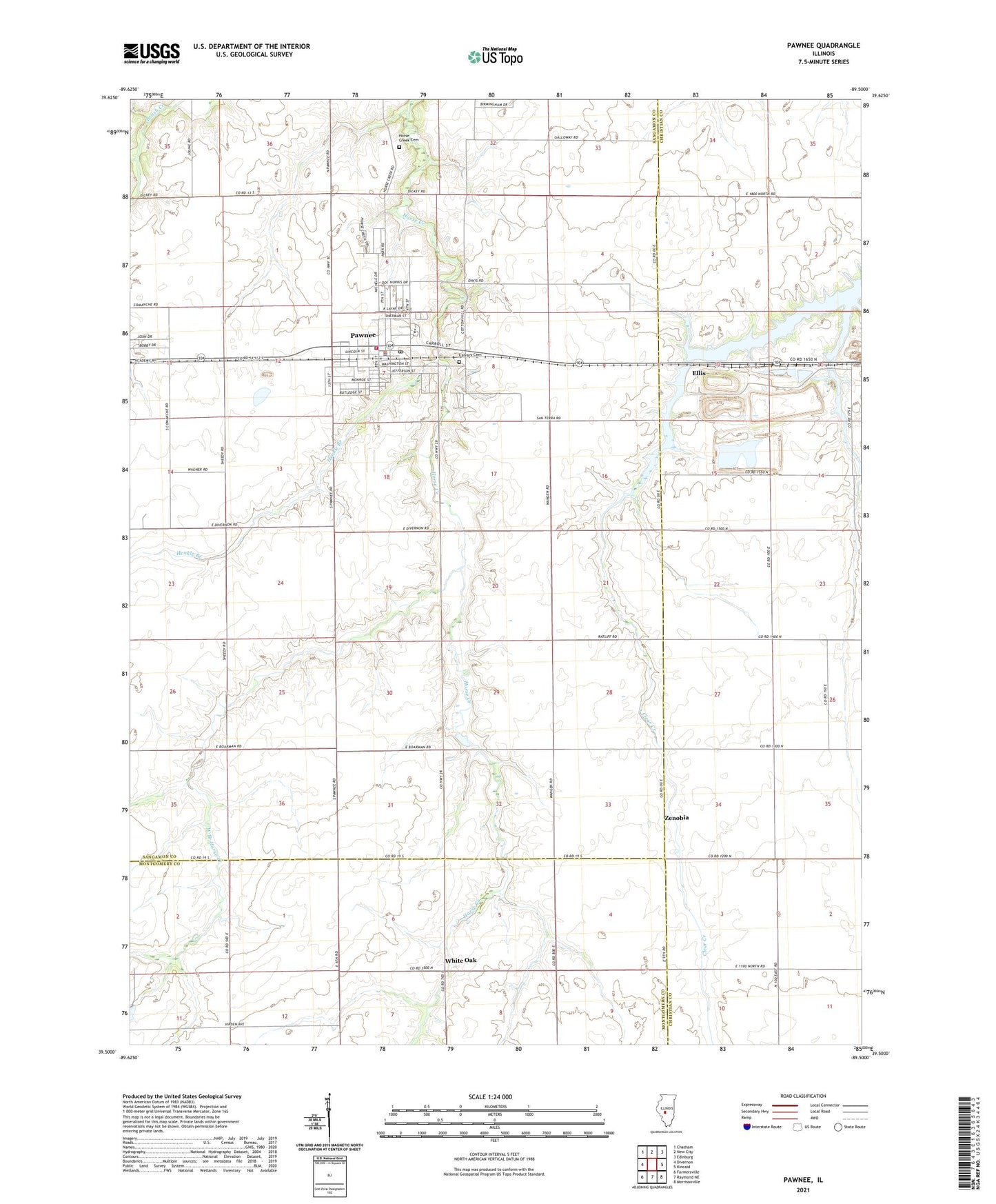
2024 topographic map quadrangle Pawnee in the state of Illinois. Scale: 1:24000. Based on the newly updated USGS 7.5' US Topo map series, this map is in the following counties: Sangamon, Christian, Montgomery. The map contains contour data, water features, and other items you are used to seeing on USGS maps, but also has updated roads and other features. This is the next generation of topographic maps. Printed on high-quality waterproof paper with UV fade-resistant inks.
Quads adjacent to this one:
West: Divernon
Northwest: Chatham
North: New City
Northeast: Edinburg
East: Kincaid
Southeast: Morrisonville
South: Raymond NE
Southwest: Farmersville
This map covers the same area as the classic USGS quad with code o39089e5.
Contains the following named places: Beaverdam School, Butler School, Calvary Cemetery, Commanche Village, Donald A. Hamilton Airport, Ellis, Fry RLA Airport, Henkle Branch, Hopewell School, Horse Creek Cemetery, Kentucky School, Lynndora School, Murphy School, Pawnee, Pawnee Fire Protection District, Pawnee Grade School, Pawnee High School, Pawnee Police Department, Pawnee Post Office, Pleasant Hill School, Saint Marys Church, Sanders School, Shiloh School, Slurry Impoundment Number 1 Dam, Slurry Impoundment Number 1 Reservoir, Township of Pawnee, United Methodist Church of Pawnee, Village of Pawnee, West Branch Horse Creek, White Oak, Zenobia, Zenobia Church, ZIP Code: 62558