MyTopo
Foosland Illinois US Topo Map
Couldn't load pickup availability
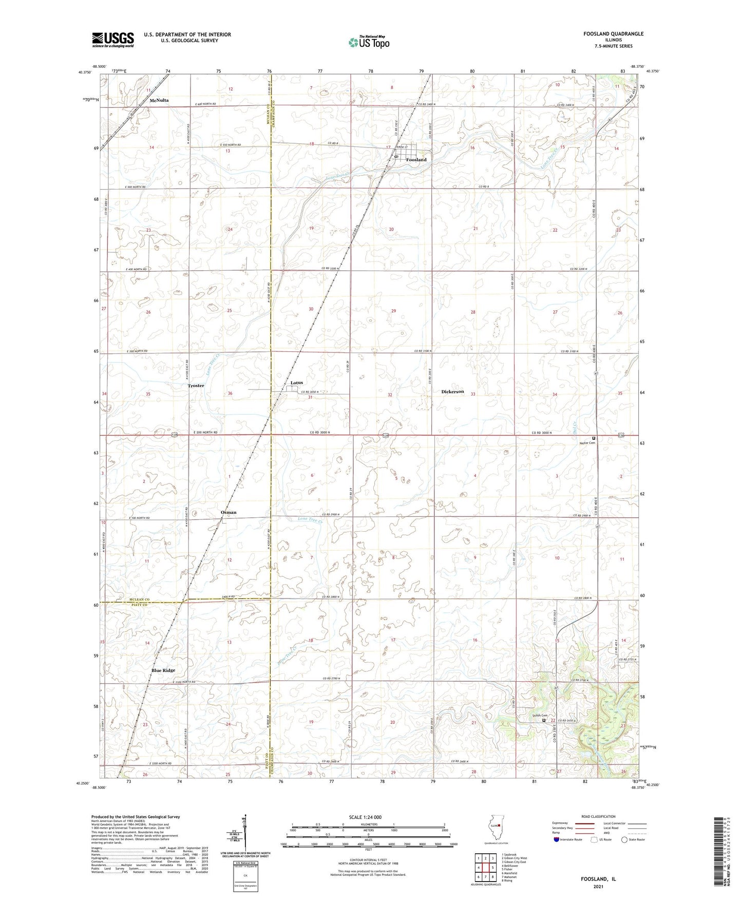
2024 topographic map quadrangle Foosland in the state of Illinois. Scale: 1:24000. Based on the newly updated USGS 7.5' US Topo map series, this map is in the following counties: Champaign, McLean, Piatt. The map contains contour data, water features, and other items you are used to seeing on USGS maps, but also has updated roads and other features. This is the next generation of topographic maps. Printed on high-quality waterproof paper with UV fade-resistant inks.
Quads adjacent to this one:
West: Bellflower
Northwest: Saybrook
North: Gibson City West
Northeast: Gibson City East
East: Fisher
Southeast: Rising
South: Mahomet
Southwest: Mansfield
This map covers the same area as the classic USGS quad with code o40088c4.
Contains the following named places: Blue Ridge, Dickerson, Foosland, Foosland Post Office, Lotus, Marvin D Bradd Airport, McNulta, Naylor Cemetery, Osman, Osman Post Office, Sangamon Valley Fire Protection District Station 3, Shiloh Cemetery, Shiloh Center Post Office, Shiloh Church, Township of Brown, Township of Newcomb, Troster, Village of Foosland, Walker Church, ZIP Code: 61845