MyTopo
Mahomet Illinois US Topo Map
Couldn't load pickup availability
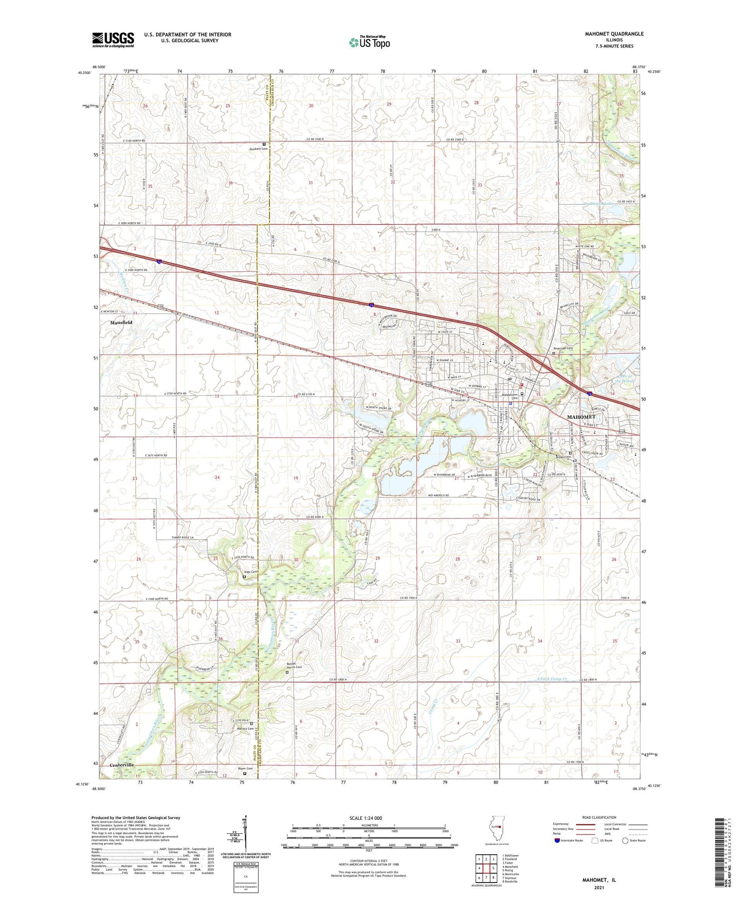
2024 topographic map quadrangle Mahomet in the state of Illinois. Scale: 1:24000. Based on the newly updated USGS 7.5' US Topo map series, this map is in the following counties: Champaign, Piatt. The map contains contour data, water features, and other items you are used to seeing on USGS maps, but also has updated roads and other features. This is the next generation of topographic maps. Printed on high-quality waterproof paper with UV fade-resistant inks.
Quads adjacent to this one:
West: Mansfield
Northwest: Bellflower
North: Foosland
Northeast: Fisher
East: Rising
Southeast: Bondville
South: Seymour
Southwest: Monticello
This map covers the same area as the classic USGS quad with code o40088b4.
Contains the following named places: Argo Cemetery, Bethel Church of Mahomet, Bethel Harris Cemetery, Boyer Cemetery, Bryan Cemetery, Camp Howard, Camp Kiwanis, Cornbelt Fire Protection District, Dunkard Cemetery, First Baptist Church, Gilbert Pit, Lake of the Woods, Lake of the Woods Dam, Lake of the Woods Park, Lincoln Trail Elementary School, Mahomet, Mahomet Gas Storage Area, Mahomet Gravel Pit, Mahomet Police Department, Mahomet Post Office, Mahomet United Methodist Church, Mahomet Water Treatment Plant, Mahomet-Seymour Junior High School, Mallory Cemetery, Middletown Cemetery, Middletown Early Childhood Center, Mohomet-Seymour High School, Oink Acres Airport, Riverside Cemetery, Sangamon Elementary School, Sangamon Park, Sangamon Valley Christian Church, South Fork Camp Creek, Spring Lake, Spring Lake Dam, Township of Mahomet, Trautman Lake, Trautman Lake Dam, Village of Mahomet, Webb Pit, ZIP Code: 61853