MyTopo
Gibson City West Illinois US Topo Map
Couldn't load pickup availability
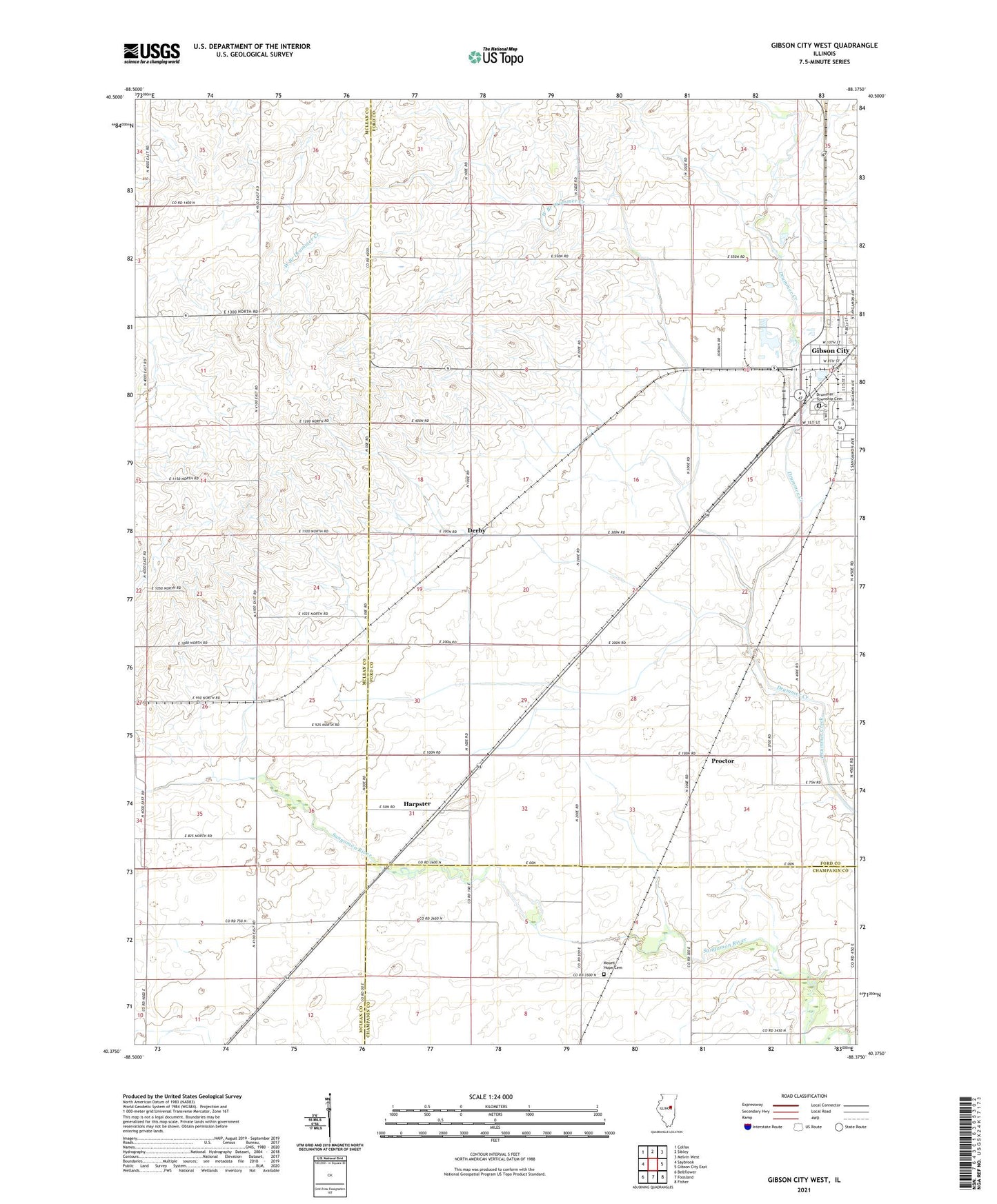
2024 topographic map quadrangle Gibson City West in the state of Illinois. Scale: 1:24000. Based on the newly updated USGS 7.5' US Topo map series, this map is in the following counties: Ford, McLean, Champaign. The map contains contour data, water features, and other items you are used to seeing on USGS maps, but also has updated roads and other features. This is the next generation of topographic maps. Printed on high-quality waterproof paper with UV fade-resistant inks.
Quads adjacent to this one:
West: Saybrook
Northwest: Colfax
North: Sibley
Northeast: Melvin West
East: Gibson City East
Southeast: Fisher
South: Foosland
Southwest: Bellflower
This map covers the same area as the classic USGS quad with code o40088d4.
Contains the following named places: City of Gibson City, Derby, Drummer Grove, Drummer Township Cemetery, First Christian Church, Gibson City, Gibson City Pentecostal Church, Gibson City Power Plant, Harpster, Harvest Moon Drive-In, Kingdom Hall of Jehovahs Witnesses, Lone Tree Creek, Lowery Park, Mount Hope Cemetery, Moyer Library, Proctor, Railside Golf Club, Sangamon School, Skeel School, Tjardes Farm, Township of Drummer, West Branch Drummer Creek, Wright Airport