MyTopo
Forrest South Illinois US Topo Map
Couldn't load pickup availability
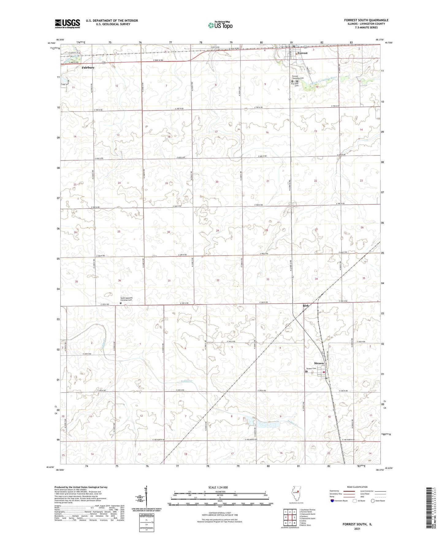
2024 topographic map quadrangle Forrest South in the state of Illinois. Scale: 1:24000. Based on the newly updated USGS 7.5' US Topo map series, this map is in the following counties: Livingston. The map contains contour data, water features, and other items you are used to seeing on USGS maps, but also has updated roads and other features. This is the next generation of topographic maps. Printed on high-quality waterproof paper with UV fade-resistant inks.
Quads adjacent to this one:
West: Fairbury
Northwest: Southeast Pontiac
North: Forrest North
Northeast: Chatsworth North
East: Chatsworth South
Southeast: Melvin West
South: Sibley
Southwest: Colfax
This map covers the same area as the classic USGS quad with code o40088f4.
Contains the following named places: Bee Hive School, Broadhead School, Center School, Five Mile Cemetery, Forrest - Strawn - Wing Fire Protection District, Forrest Post Office, Forrest Township Cemetery, Frye School, Keeley School, Knaur School, Murphy Station, Potter School, Risk, Rudd School, Saint Rose Catholic Church, South Apostolic Christian Cemetery, South Church, Strawn, Strawn Cemetery, Strawn High School, Strawn Post Office, Strawn United Methodist Church, Township of Fayette, Township of Forrest, Village of Strawn, Village Park, Weeks School, ZIP Code: 61775