MyTopo
Sibley Illinois US Topo Map
Couldn't load pickup availability
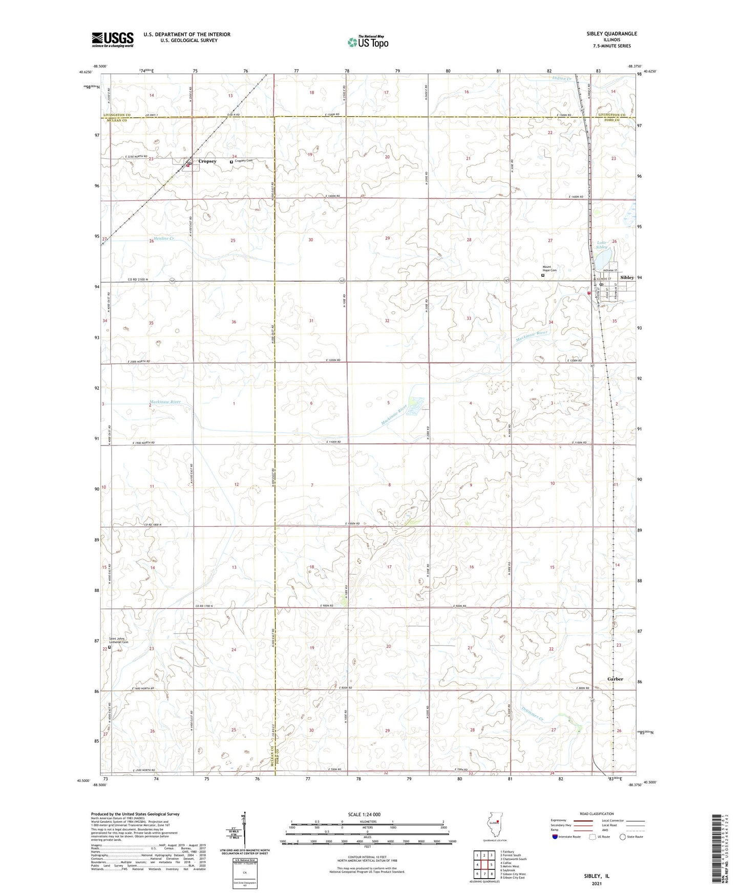
2024 topographic map quadrangle Sibley in the state of Illinois. Scale: 1:24000. Based on the newly updated USGS 7.5' US Topo map series, this map is in the following counties: Ford, McLean, Livingston. The map contains contour data, water features, and other items you are used to seeing on USGS maps, but also has updated roads and other features. This is the next generation of topographic maps. Printed on high-quality waterproof paper with UV fade-resistant inks.
Quads adjacent to this one:
West: Colfax
Northwest: Fairbury
North: Forrest South
Northeast: Chatsworth South
East: Melvin West
Southeast: Gibson City East
South: Gibson City West
Southwest: Saybrook
This map covers the same area as the classic USGS quad with code o40088e4.
Contains the following named places: Anchor Church, Ashley School, Cropsey, Cropsey Cemetery, Cropsey Fire Department, Cropsey Post Office, Fairview School, Garber, Lake Genevieve, Lake Sibley, Miller School, Mount Hope Cemetery, Mount Zion School, North Union School, Pleasant Ridge School, Saint Johns Church, Saint Johns Lutheran Cemetery, Sibley, Sibley Post Office, Sullivan Township Fire Protection District - Sibley Fire Department, Township of Sullivant, Village of Sibley, ZIP Codes: 61731, 61773