MyTopo
Garden Prairie Illinois US Topo Map
Couldn't load pickup availability
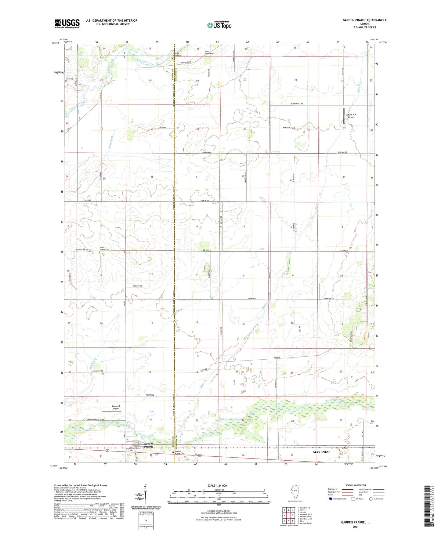
2024 topographic map quadrangle Garden Prairie in the state of Illinois. Scale: 1:24000. Based on the newly updated USGS 7.5' US Topo map series, this map is in the following counties: McHenry, Boone. The map contains contour data, water features, and other items you are used to seeing on USGS maps, but also has updated roads and other features. This is the next generation of topographic maps. Printed on high-quality waterproof paper with UV fade-resistant inks.
Quads adjacent to this one:
West: Belvidere North
Northwest: Belvidere NE
North: Capron
Northeast: Harvard
East: Marengo North
Southeast: Marengo South
South: Riley
Southwest: Belvidere South
This map covers the same area as the classic USGS quad with code o42088c6.
Contains the following named places: Adkins RLA Airport, County Line Cemetery, County Line School, Deneen Farms, East Bonus Cemetery, Garden Prairie, Garden Prairie Cemetery, Garden Prairie Census Designated Place, Garden Prairie Post Office, Hawthorne Elementary School, Hoppen School, Island School, Kaufield Airport, Kishwaukee Elementary School, Marengo Farms, Mill School, Nolan School, Olcott School, Pierce Farms, Porter School, Poyer School, Rush Creek, Shanks Farm, Stimes School, Stone School, Stone School Cemetery, Thorne School, Township of Boone, Township of Dunham, Township of Marengo, Village of Garden Prairie, Willard School, ZIP Code: 61038