MyTopo
Washburn Illinois US Topo Map
Couldn't load pickup availability
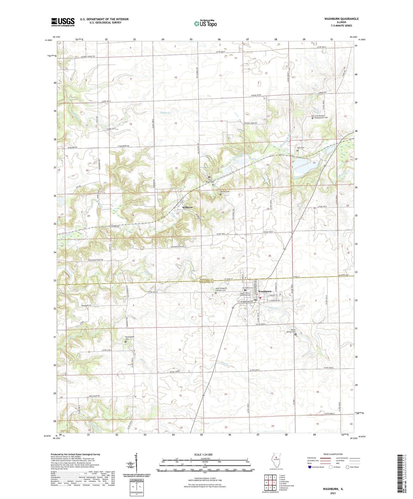
2024 topographic map quadrangle Washburn in the state of Illinois. Scale: 1:24000. Based on the newly updated USGS 7.5' US Topo map series, this map is in the following counties: Marshall, Woodford. The map contains contour data, water features, and other items you are used to seeing on USGS maps, but also has updated roads and other features. This is the next generation of topographic maps. Printed on high-quality waterproof paper with UV fade-resistant inks.
Quads adjacent to this one:
West: Chillicothe
Northwest: Lacon
North: Henry
Northeast: Varna
East: La Rose
Southeast: Roanoke
South: Metamora
Southwest: Germantown Hills
This map covers the same area as the classic USGS quad with code o40089h3.
Contains the following named places: Barnes Cemetery, Bell Cemetery, Buckingham Cemetery, Crow Meadow Presbyterian Cemetery, Fort Dever Cemetery, Garfield School, Garrison School, Greeley School, Hull School, Lowpoint-Washburn Elementary School, Lowpoint-Washburn High School, Maple School, Mount Vernon Cemetery, North Branch Crow Creek, Saint Elizabeth Catholic Cemetery, Saint Johns Lutheran Cemetery, Sherwoods Run, South Branch Crow Creek, Strawn School, Sulphur Spring School, Township of Cazenovia, Township of Richland, Vernon School, Village of Washburn, Washburn, Washburn Fire and Ambulance Department, Washburn Post Office, Webster School, Wilbern, ZIP Code: 61570