MyTopo
Griggsville Illinois US Topo Map
Couldn't load pickup availability
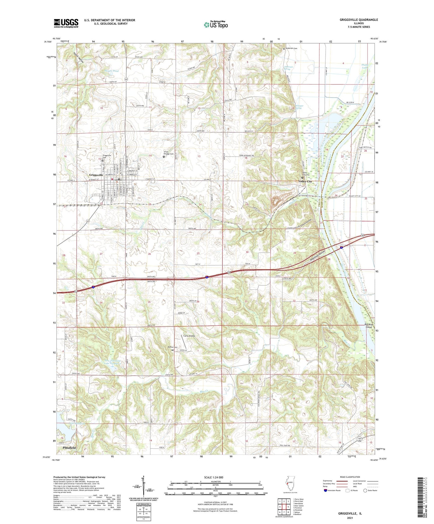
2024 topographic map quadrangle Griggsville in the state of Illinois. Scale: 1:24000. Based on the newly updated USGS 7.5' US Topo map series, this map is in the following counties: Pike, Scott. The map contains contour data, water features, and other items you are used to seeing on USGS maps, but also has updated roads and other features. This is the next generation of topographic maps. Printed on high-quality waterproof paper with UV fade-resistant inks.
Quads adjacent to this one:
West: New Salem
Northwest: Perry West
North: Perry East
Northeast: Meredosia
East: Florence
Southeast: Bedford
South: Milton
Southwest: Pittsfield
This map covers the same area as the classic USGS quad with code o39090f6.
Contains the following named places: Anderson Cemetery, Anderson Spring, Bethel Cemetery, Bethel Church, Bethel School, Big Blue Island, Blue Creek, Boss Wilson Pond, Brush College School, Burr Lake, Church Hollow, City of Griggsville, Curry Airport, Flint Creek, Goldman School, Greenfield School, Griggsville, Griggsville Cemetery, Griggsville Fire Department, Griggsville High School, Griggsville Historic District, Griggsville Landing, Griggsville Post Office, Hatch Hollow, Holy Family Church, Mauvaise Terre Creek, McCoe Lake, Napolean Hollow, New Pittsfield Lake Number 1, New Pittsfield Lake Number 1 Dam, New Pittsfield Lake Number 2, New Pittsfield Lake Number 2 Dam, North Flint School, Phillips Ferry, Pike County Conservation Area, Scott County Pumping Station, Shelly Lake, Shelly School, Sleight Pond, South Flint School, Tollgate School, Township of Flint, Township of Griggsville, Uriah Elledge Cemetery, Valley City, Valley City Cemetery, Valley City Pumping Station, Valley City Quarry, Village of Valley City, Wilson School, Winegar Spring, ZIP Code: 62340