MyTopo
Perry West Illinois US Topo Map
Couldn't load pickup availability
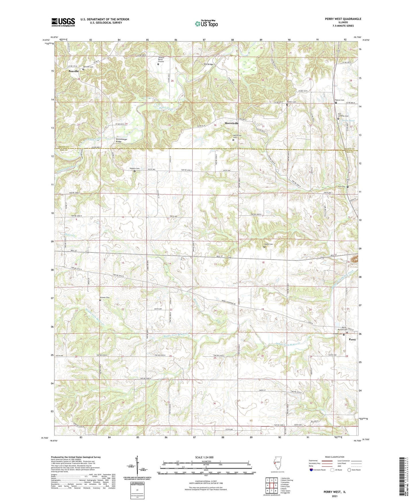
2024 topographic map quadrangle Perry West in the state of Illinois. Scale: 1:24000. Based on the newly updated USGS 7.5' US Topo map series, this map is in the following counties: Pike, Brown. The map contains contour data, water features, and other items you are used to seeing on USGS maps, but also has updated roads and other features. This is the next generation of topographic maps. Printed on high-quality waterproof paper with UV fade-resistant inks.
Quads adjacent to this one:
West: Fishhook
Northwest: Kellerville
North: Mount Sterling
Northeast: Versailles
East: Perry East
Southeast: Griggsville
South: New Salem
Southwest: Baylis
This map covers the same area as the classic USGS quad with code o39090g7.
Contains the following named places: Benville, Benville Cemetery, Bottom Prairie School, Bower Creek, Bower School, Brower Cemetery, Dexter School, Dixon Pond, Dixon Pond Dam, Fairmount Church, Gardner School, Grimes School, Grove School, Hebron Cemetery, Hebron Church, Hopewell School, Lutz Cemetery, Morrelville, Morrelville Cemetery, Mountain Airport, Perry - McCord Cemetery, Rattlesnake Den Creek, Rush School, Seaborn Cemetery, Shadydale School, Shinnebarger Bridge, South Prairie School, Stoner Cemetery, Taylor Cemetery, Test Bridge, Township of Fairmount, Wilson - Perry McCord Cemetery, Wilson Cemetery, Wilson Ford, Zion Church, Zion Lutheran Cemetery