MyTopo
New Salem Illinois US Topo Map
Couldn't load pickup availability
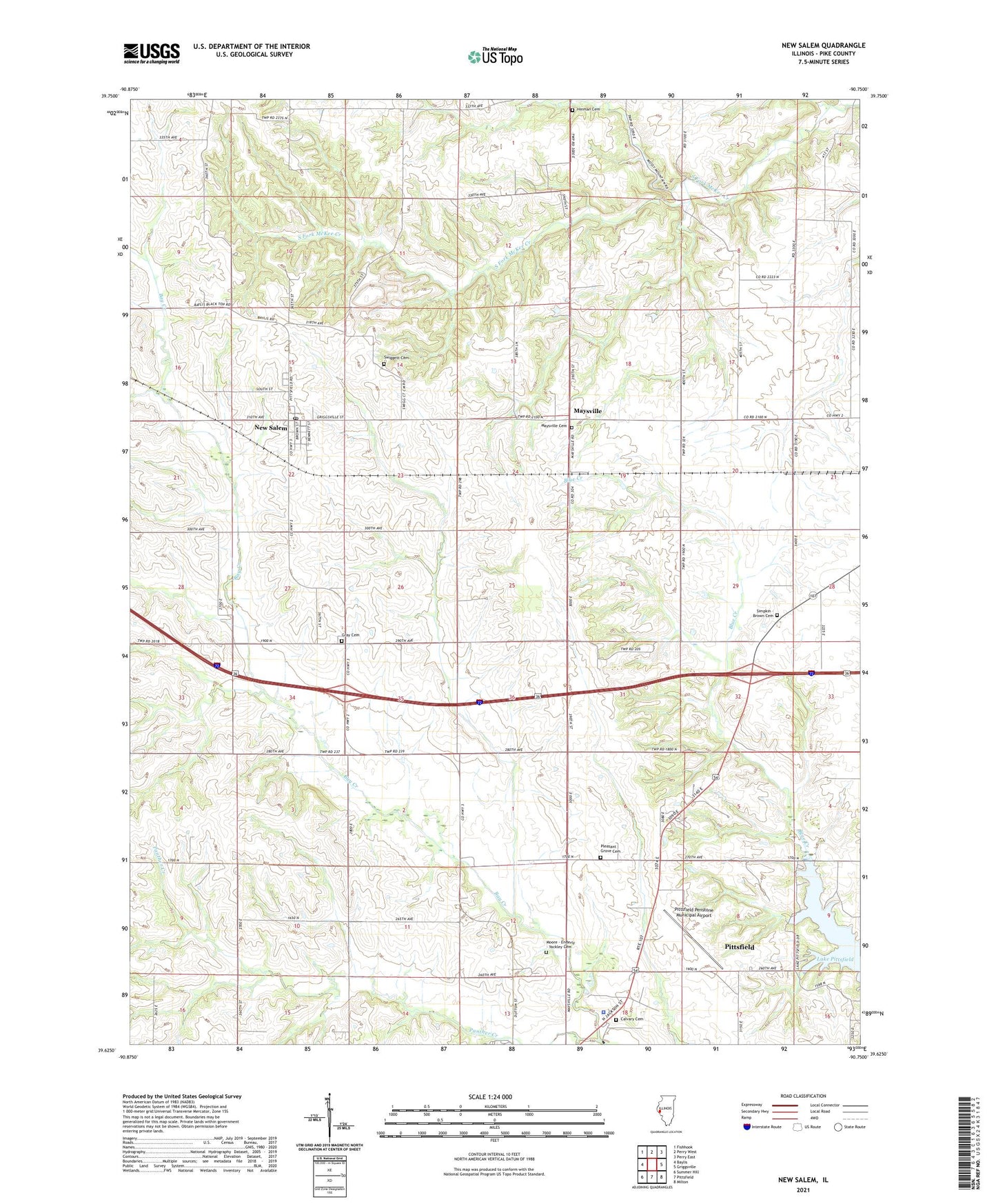
2024 topographic map quadrangle New Salem in the state of Illinois. Scale: 1:24000. Based on the newly updated USGS 7.5' US Topo map series, this map is in the following counties: Pike. The map contains contour data, water features, and other items you are used to seeing on USGS maps, but also has updated roads and other features. This is the next generation of topographic maps. Printed on high-quality waterproof paper with UV fade-resistant inks.
Quads adjacent to this one:
West: Baylis
Northwest: Fishhook
North: Perry West
Northeast: Perry East
East: Griggsville
Southeast: Milton
South: Pittsfield
Southwest: Summer Hill
This map covers the same area as the classic USGS quad with code o39090f7.
Contains the following named places: Bradbury Grove School, Calvary Cemetery, Cork School, Cottage Grove School, Crump School, Dutton, Gray Cemetery, Gray School, Hinman Cemetery, Illinois State Police Department District 20, Lake Pittsfield, Maysville, Maysville Cemetery, Maysville Station, Moore - Enderly - Yackley Cemetery, New Salem, New Salem Post Office, Panther Creek, Pittsfield Penstone Municipal Airport, Pleasant Grove Cemetery, Pleasant Grove School, Simpkin - Brown Cemetery, Starkey School, Swiggett Cemetery, Teneriffe School, Township of New Salem, Village of New Salem, Walnut Grove School, York School, ZIP Code: 62357