MyTopo
La Rose Illinois US Topo Map
Couldn't load pickup availability
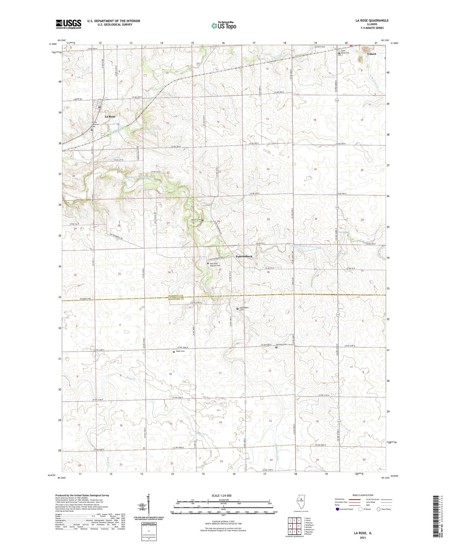
2024 topographic map quadrangle La Rose in the state of Illinois. Scale: 1:24000. Based on the newly updated USGS 7.5' US Topo map series, this map is in the following counties: Marshall, Woodford. The map contains contour data, water features, and other items you are used to seeing on USGS maps, but also has updated roads and other features. This is the next generation of topographic maps. Printed on high-quality waterproof paper with UV fade-resistant inks.
Quads adjacent to this one:
West: Washburn
Northwest: Henry
North: Varna
Northeast: Wenona
East: Minonk
Southeast: Benson
South: Roanoke
Southwest: Metamora
This map covers the same area as the classic USGS quad with code o40089h2.
Contains the following named places: Bell Plain Baptist Cemetery, Davison Cemetery, Davison RLA Airport, Hallenback Creek, Hawk Cemetery, Hollenback Cemetery, La Rose, La Rose Post Office, Linn Township Hall, Martin Cemetery, Pattonsburg, Saint Anns Cemetery, Saint Johns Cemetery, Snake Creek, Tall Oaks Country Club, Toluca Fire Protection District and Ambulance Service, Township of Bell Plain, Township of Linn, Trinity Lutheran Cemetery, Village of La Rose, ZIP Codes: 61369, 61541