MyTopo
Hagarstown Illinois US Topo Map
Couldn't load pickup availability
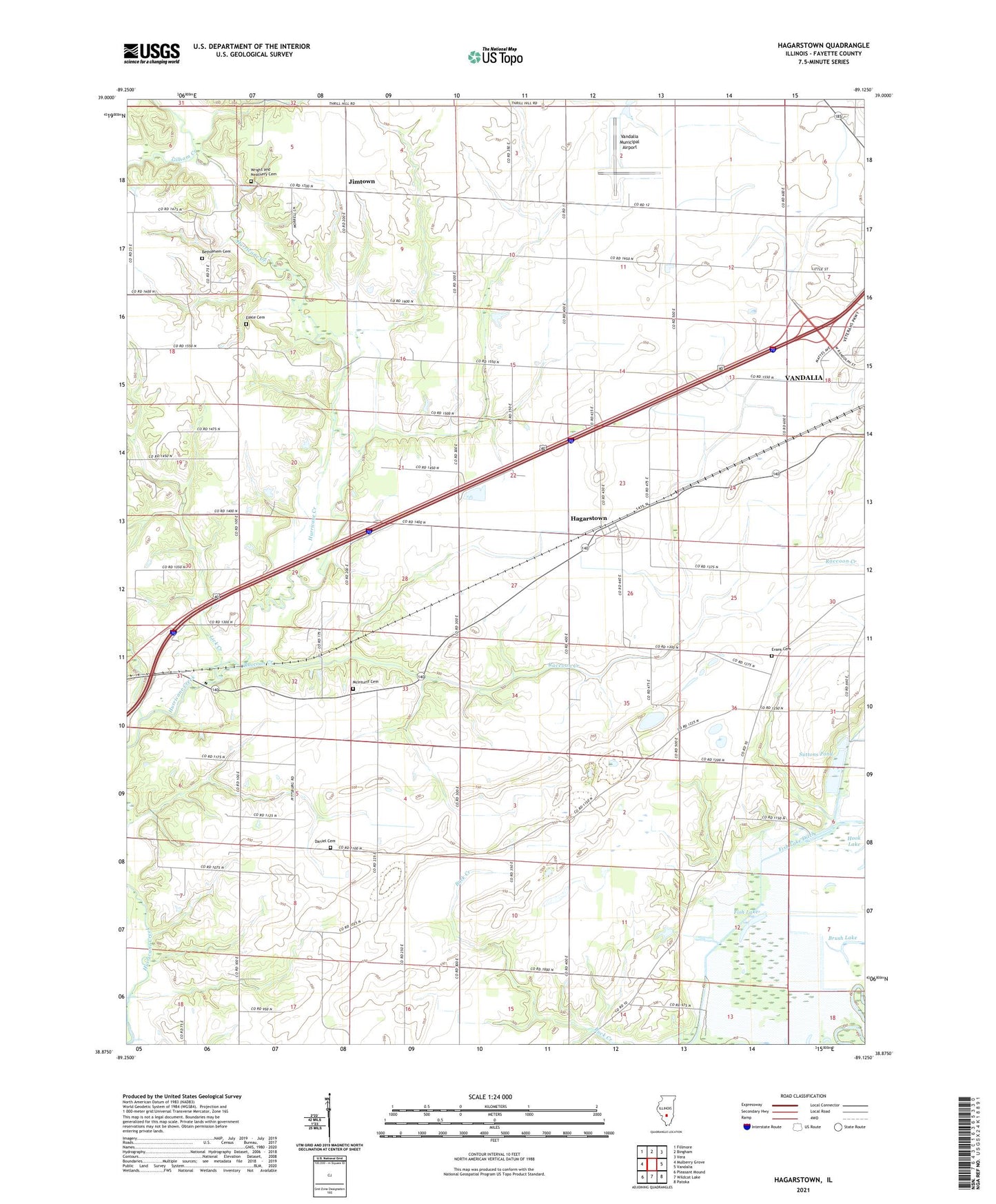
2024 topographic map quadrangle Hagarstown in the state of Illinois. Scale: 1:24000. Based on the newly updated USGS 7.5' US Topo map series, this map is in the following counties: Fayette. The map contains contour data, water features, and other items you are used to seeing on USGS maps, but also has updated roads and other features. This is the next generation of topographic maps. Printed on high-quality waterproof paper with UV fade-resistant inks.
Quads adjacent to this one:
West: Mulberry Grove
Northwest: Fillmore
North: Bingham
Northeast: Vera
East: Vandalia
Southeast: Patoka
South: Wildcat Lake
Southwest: Pleasant Mound
This map covers the same area as the classic USGS quad with code o38089h2.
Contains the following named places: Alton School, Bethlehem Cemetery, Bethlehem Church, Bowles School, Brush Lake, Center School, Clover College School, Crown Point Church, Daniel Cemetery, Eakle Cemetery, Elm Grove School, Evans Cemetery, Evans School, Fish Lake, Fish Lake Ditch, Gilham Creek, Hagarstown, Hagarstown Post Office, Hurricane Church, Jimtown, Lick Creek, Lutz Airport, Lutz Spur, McInturff Cemetery, Oak Grove School, Owl Creek, Pond Grove School, Prairie Mound School, Raccoon Creek, Seminary School, Suttons Pond, Township of Bear Grove, Vandalia Municipal Airport, Wescott Church, Wright and Neathery Cemetery, ZIP Code: 62471