MyTopo
Fillmore Illinois US Topo Map
Couldn't load pickup availability
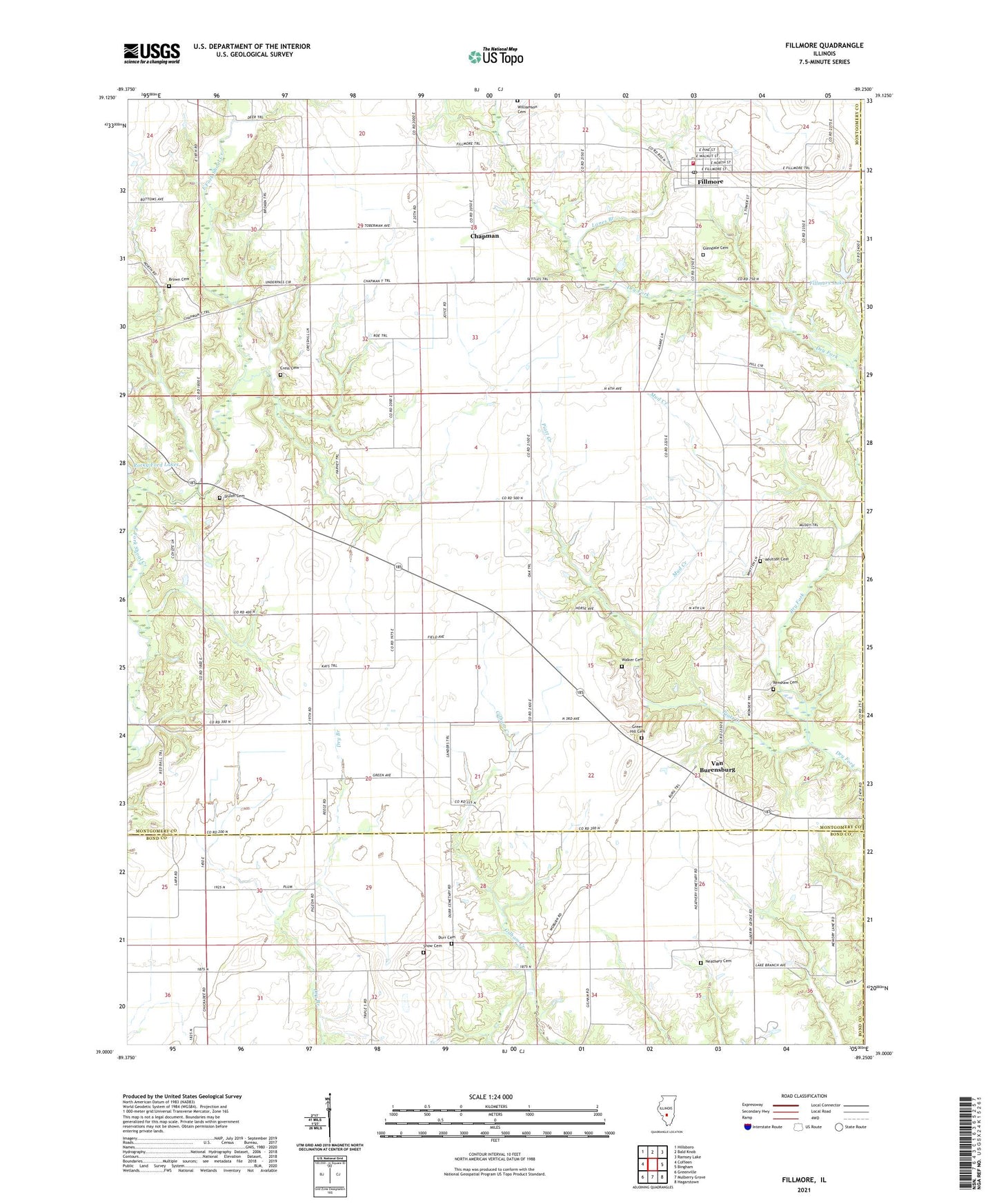
2024 topographic map quadrangle Fillmore in the state of Illinois. Scale: 1:24000. Based on the newly updated USGS 7.5' US Topo map series, this map is in the following counties: Montgomery, Bond, Fayette. The map contains contour data, water features, and other items you are used to seeing on USGS maps, but also has updated roads and other features. This is the next generation of topographic maps. Printed on high-quality waterproof paper with UV fade-resistant inks.
Quads adjacent to this one:
West: Coffeen
Northwest: Hillsboro
North: Bald Knob
Northeast: Ramsey Lake
East: Bingham
Southeast: Hagarstown
South: Mulberry Grove
Southwest: Greenville
This map covers the same area as the classic USGS quad with code o39089a3.
Contains the following named places: Alexander School, Brown Cemetery, Chapman, Crab Apple School, Cress Cemetery, Durr Cemetery, East Fork Church, East Fork School, Egypt School, Fillmore, Fillmore Baptist Church, Fillmore Community Fire Protection District, Fillmore Lake, Fillmore Lake Dam, Fillmore Post Office, Forsee Vineyards, Gilham School, Glendale Cemetery, Green Hill Cemetery, Hurricane Church, Jerusalem School, Lanes Branch, Liberty Church, Mount Moriah Church, Mud Creek, Neathery Cemetery, Neathery School, New Boston School, Piatt Creek, Renshaw Cemetery, Saint Matthew Lutheran Church, Shiloh Cemetery, Shiloh Church, Snow Cemetery, Township of Fillmore Consolidated, Township of South Fillmore, Van Burensburg, Village of Fillmore, Walker Cemetery, Whitten Cemetery, Williamson Cemetery, ZIP Codes: 62017, 62032