MyTopo
Princeville Illinois US Topo Map
Couldn't load pickup availability
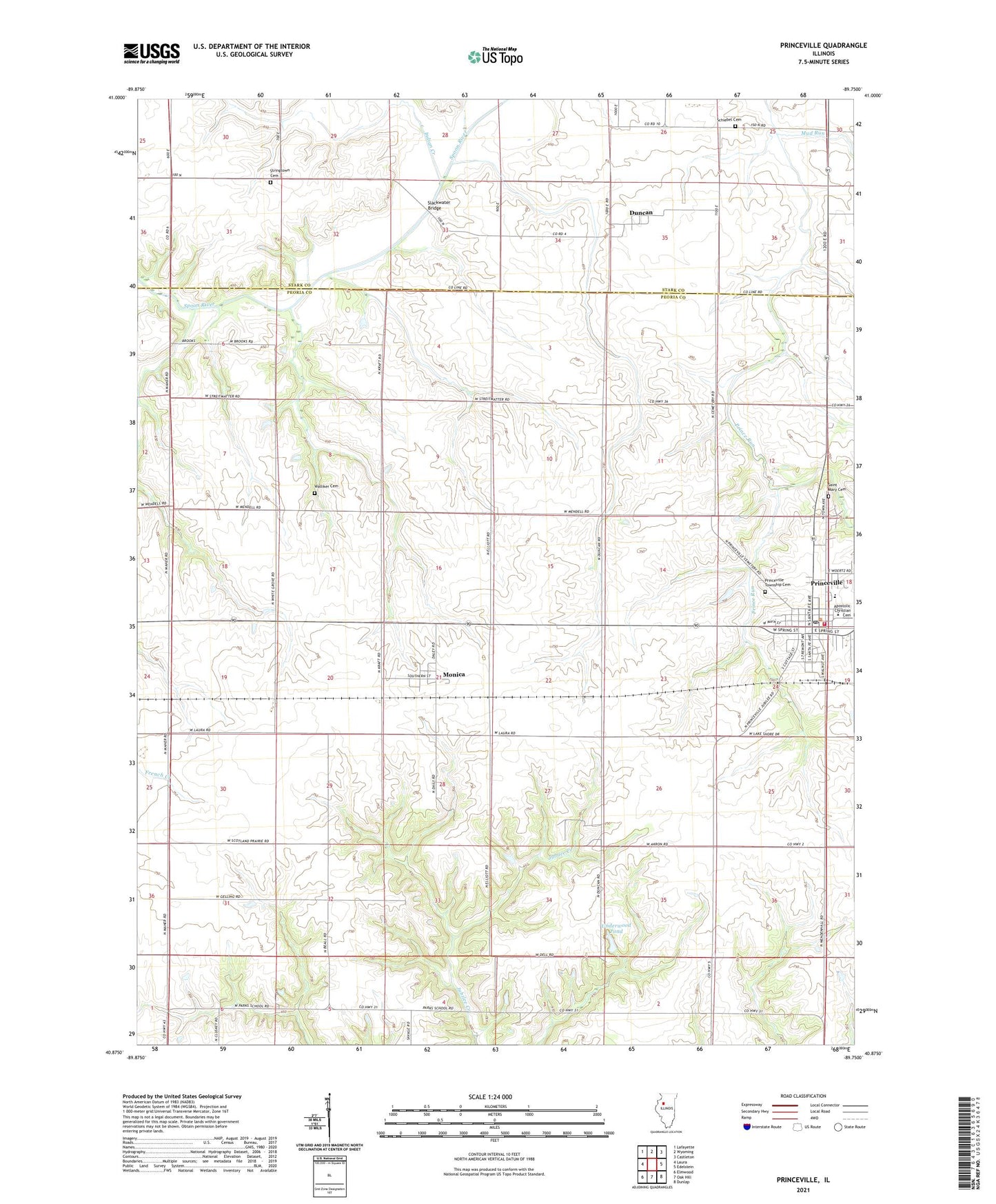
2024 topographic map quadrangle Princeville in the state of Illinois. Scale: 1:24000. Based on the newly updated USGS 7.5' US Topo map series, this map is in the following counties: Peoria, Stark. The map contains contour data, water features, and other items you are used to seeing on USGS maps, but also has updated roads and other features. This is the next generation of topographic maps. Printed on high-quality waterproof paper with UV fade-resistant inks.
Quads adjacent to this one:
West: Laura
Northwest: Lafayette
North: Wyoming
Northeast: Castleton
East: Edelstein
Southeast: Dunlap
South: Oak Hill
Southwest: Elmwood
This map covers the same area as the classic USGS quad with code o40089h7.
Contains the following named places: Adams School, Akron - Princeville Ambulance, Akron - Princeville Fire Department, Byrnes School, Carroll School, Chippewa Estates Dam, Chippewa Estates Lake, Duncan, First Presbyterian Church, Good Hope School, Henry School, Indian Creek, Monica, Moody School, Nelson School, Phils Airstrip, Prince Run, Princeville, Princeville Baptist Church, Princeville Elementary School, Princeville High School, Princeville Post Office, Princeville Township Cemetery, Princeville United Methodist Church, Saint Mary Cemetery, Saint Mary of the Wood Church, Schiebel Cemetery, Schiebel School, Slackwater, Slackwater Bridge, Stringtown Cemetery, Stringtown School, Township of Princeville, Underwood Pond, Underwood Pond Dam, Village of Princeville, Walliker Cemetery, Whites Grove School, ZIP Code: 61559