MyTopo
Orangeville Illinois US Topo Map
Couldn't load pickup availability
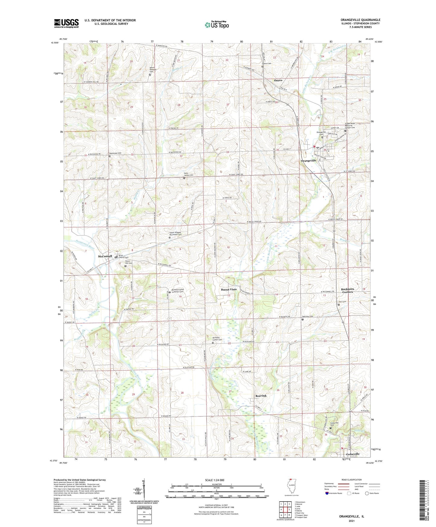
2024 topographic map quadrangle Orangeville in the state of Illinois. Scale: 1:24000. Based on the newly updated USGS 7.5' US Topo map series, this map is in the following counties: Stephenson. The map contains contour data, water features, and other items you are used to seeing on USGS maps, but also has updated roads and other features. This is the next generation of topographic maps. Printed on high-quality waterproof paper with UV fade-resistant inks.
Quads adjacent to this one:
West: Lena
Northwest: Browntown
North: Monroe
Northeast: Juda
East: Dakota
Southeast: Freeport East
South: Freeport West
Southwest: Pearl City
This map covers the same area as the classic USGS quad with code o42089d6.
Contains the following named places: Basswood Cemetery, Basswood Church, Basswood School, Bellview Cemetery, Bellview School, Brick Church Cemetery, Brush Creek, Buckhorn Corners, Buena Vista, Cedarville, Cedarville Cemetery, Cedarville Fire Protection District, Franklin School, Harrison School, McConnell, McConnell Post Office, Mount Pleasant Cemetery, Mount Pleasant School, Muddy Creek, Oneco, Oneco Cemetery, Orangeville, Orangeville Cemetery, Orangeville Elementary School, Orangeville High School, Orangeville Post Office, Orangeville United Methodist Church, Orangeville Volunteer Fire Department, Pleasant Hill School, Pleasure Valley Landing Area, Red Oak, Red Oak Post Office, Richland Cemetery, Richland Center Cemetery, Richland Center School, Richland Church, Richland Empire School, Richland Salem Church, Richland Salem Lutheran Cemetery, Saint James Cemetery, Salem School, Salem Shippee Mcconnell Cemetery, Silent Hill Cemetery, Spring Creek, Township of Buckeye, Township of Oneco, Village of Cedarville, Village of Orangeville, Waddams Center Post Office, Waddams Center School, Waddams Creek, Wagner Quarry, Wayside Park, Zion Cemetery, ZIP Code: 61050