MyTopo
Dakota Illinois US Topo Map
Couldn't load pickup availability
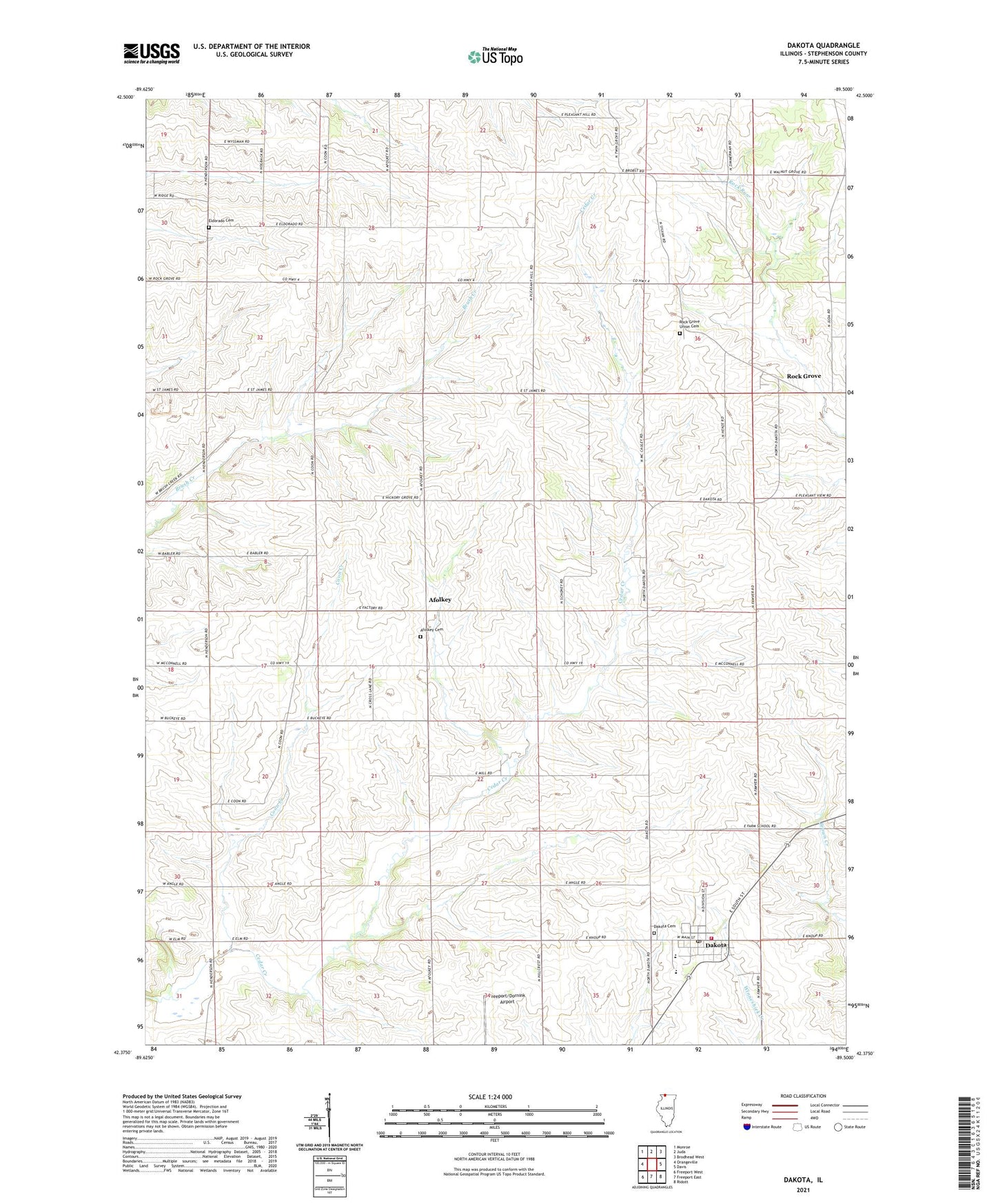
2024 topographic map quadrangle Dakota in the state of Illinois. Scale: 1:24000. Based on the newly updated USGS 7.5' US Topo map series, this map is in the following counties: Stephenson. The map contains contour data, water features, and other items you are used to seeing on USGS maps, but also has updated roads and other features. This is the next generation of topographic maps. Printed on high-quality waterproof paper with UV fade-resistant inks.
Quads adjacent to this one:
West: Orangeville
Northwest: Monroe
North: Juda
Northeast: Brodhead West
East: Davis
Southeast: Ridott
South: Freeport East
Southwest: Freeport West
This map covers the same area as the classic USGS quad with code o42089d5.
Contains the following named places: Afolkey, Afolkey Cemetery, Afolkey School, Bethel Church, Brush Creek School, Buckeye School, Busjahn Farms, Center Hill School, Champion Hill School, Coon Creek, Dakota, Dakota Cemetery, Dakota Community Presbyterian Church, Dakota Fire Protection District, Dakota High School, Dakota Post Office, Dakota United Methodist Church, Eldorado Cemetery, Eldorado School, Fountain Creek Post Office, Hickory Grove Dairy, Hickory Grove School, Monte Quarry, Mount Pleasant School, Pleasant Hill School, Rock Grove, Rock Grove Union Cemetery, Stearns Landing Strip, Sylvan School, Tammany School, Township of Dakota, Village of Dakota, Wirth Prairie Nature Preserve, ZIP Codes: 61018, 61060