MyTopo
Ramsey Lake Illinois US Topo Map
Couldn't load pickup availability
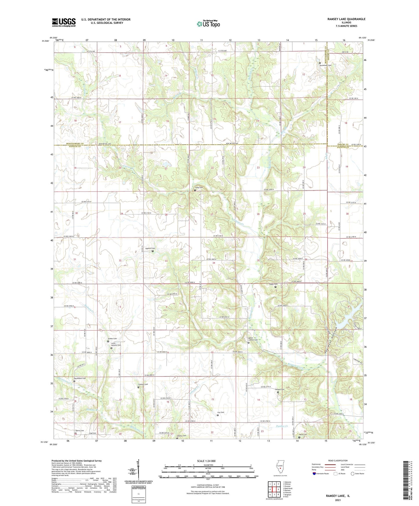
2024 topographic map quadrangle Ramsey Lake in the state of Illinois. Scale: 1:24000. Based on the newly updated USGS 7.5' US Topo map series, this map is in the following counties: Fayette, Montgomery, Shelby. The map contains contour data, water features, and other items you are used to seeing on USGS maps, but also has updated roads and other features. This is the next generation of topographic maps. Printed on high-quality waterproof paper with UV fade-resistant inks.
Quads adjacent to this one:
West: Bald Knob
Northwest: Nokomis
North: Ohlman
Northeast: Oconee
East: Ramsey
Southeast: Vera
South: Bingham
Southwest: Fillmore
This map covers the same area as the classic USGS quad with code o39089b2.
Contains the following named places: Bailey Branch, Big Three School, Blackberry Fork Picnic Area, Caesar Creek, Carlock Cemetery, Casey Cemetery, Coon Ridge Picnic Area, Crabapple Ridge Camping Area, Craig Cemetery, Craigtown School, Donaldson Cemetery, Elliott Creek, Fairview Community Center, Fairview School, Fox Cemetery, Fox Hunt Hollow, Fox Knoll Picnic Area, Gamble Branch, Halford Cemetery, Halford Chapel, Harris Cemetery, Hickory Creek, Hickory Grove Camping Area, Lake View Picnic Area, Liberty Cemetery, Liberty Church, Little Hickory Cemetery, Little Hickory Church, Little Hickory School, Mount Carmel Cemetery, Mount Carmel Church, Mount Zion School, Nave Cemetery, New Bethel Church, Oak Valley Church, Otter Branch, Pine Bend Picnic Area, Poland Cemetery, Prairie Mound School, Ramsey Hills Nature Trail, Ramsey Lake, Ramsey Lake Dam, Ramsey Lake State Park, Shady Grove Picnic Area, Sterling School, Stokes Cemetery, Success School, Tennessee Cemetery, Township of Hurricane, Virden School, White Oak Camping Area, Whitfield Lake, Whitfield Lake Dam, Whitten School, ZIP Code: 62011