MyTopo
Danby Missouri US Topo Map
Couldn't load pickup availability
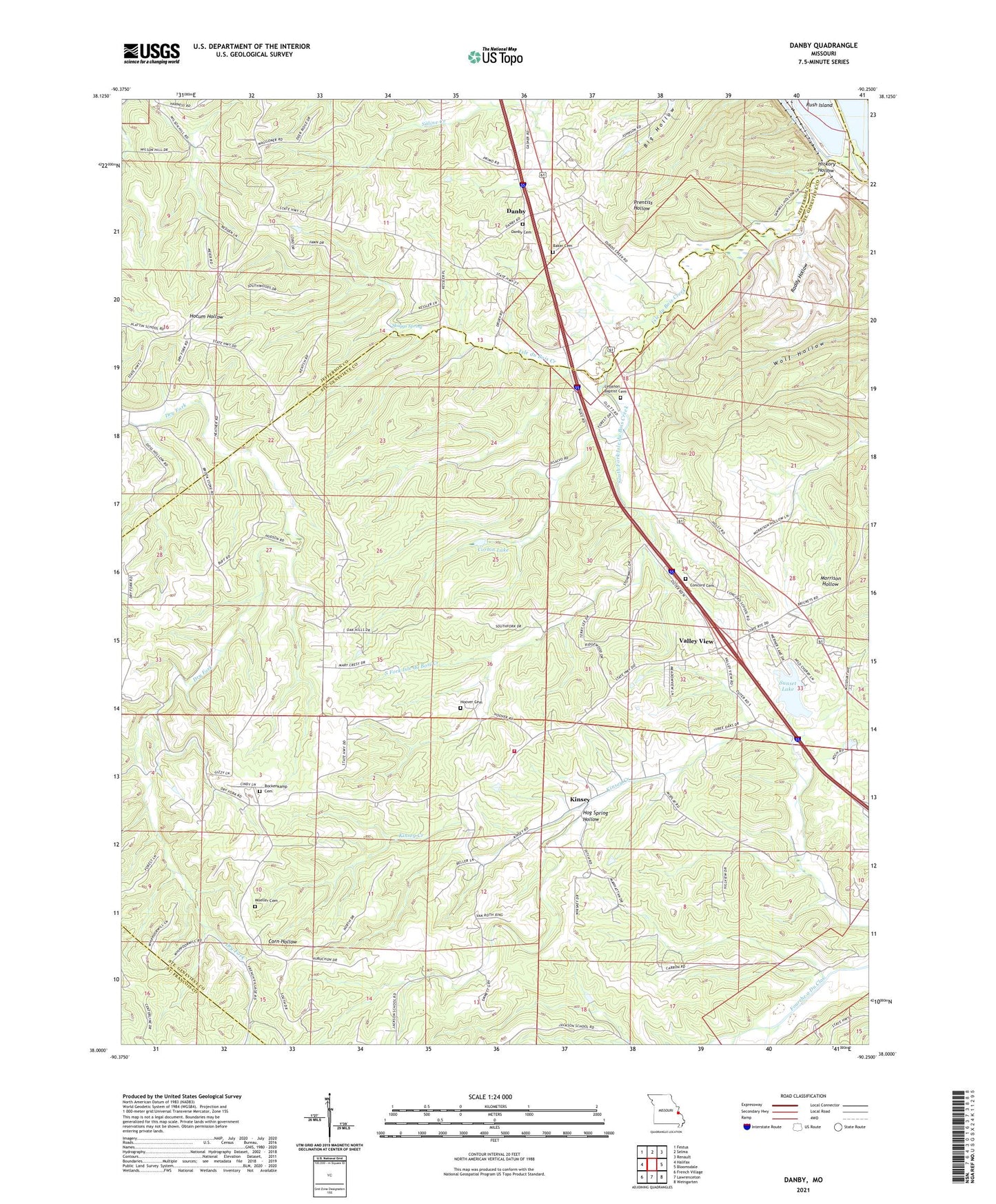
2021 topographic map quadrangle Danby in the state of Missouri. Scale: 1:24000. Based on the newly updated USGS 7.5' US Topo map series, this map is in the following counties: Ste. Genevieve, Jefferson, St. Francois. The map contains contour data, water features, and other items you are used to seeing on USGS maps, but also has updated roads and other features. This is the next generation of topographic maps. Printed on high-quality waterproof paper with UV fade-resistant inks.
Quads adjacent to this one:
West: Halifax
Northwest: Festus
North: Selma
Northeast: Renault
East: Bloomsdale
Southeast: Weingarten
South: Lawrenceton
Southwest: French Village
This map covers the same area as the classic USGS quad with code o38090a3.
Contains the following named places: Baker Cemetery, Bockenkamp Cemetery, Cedar Glade School, Concord Cemetery, Concord School, Corbin Lake, Corbin Lake Dam, Danby, Hickory Hollow, Hog Spring Hollow, Hoover Cemetery, Jackson School, Kinsey, Kinsey Volunteer Fire Department, Lebanon Church, Moeller Cemetery, Raddy Hollow, Skaggs Spring, South Fork Isle du Bois Creek, Stony Point School, Sunset Lake, Sunset Lake Dam, Township of Jackson, Valley View, Valley View Census Designated Place, ZIP Code: 63627