MyTopo
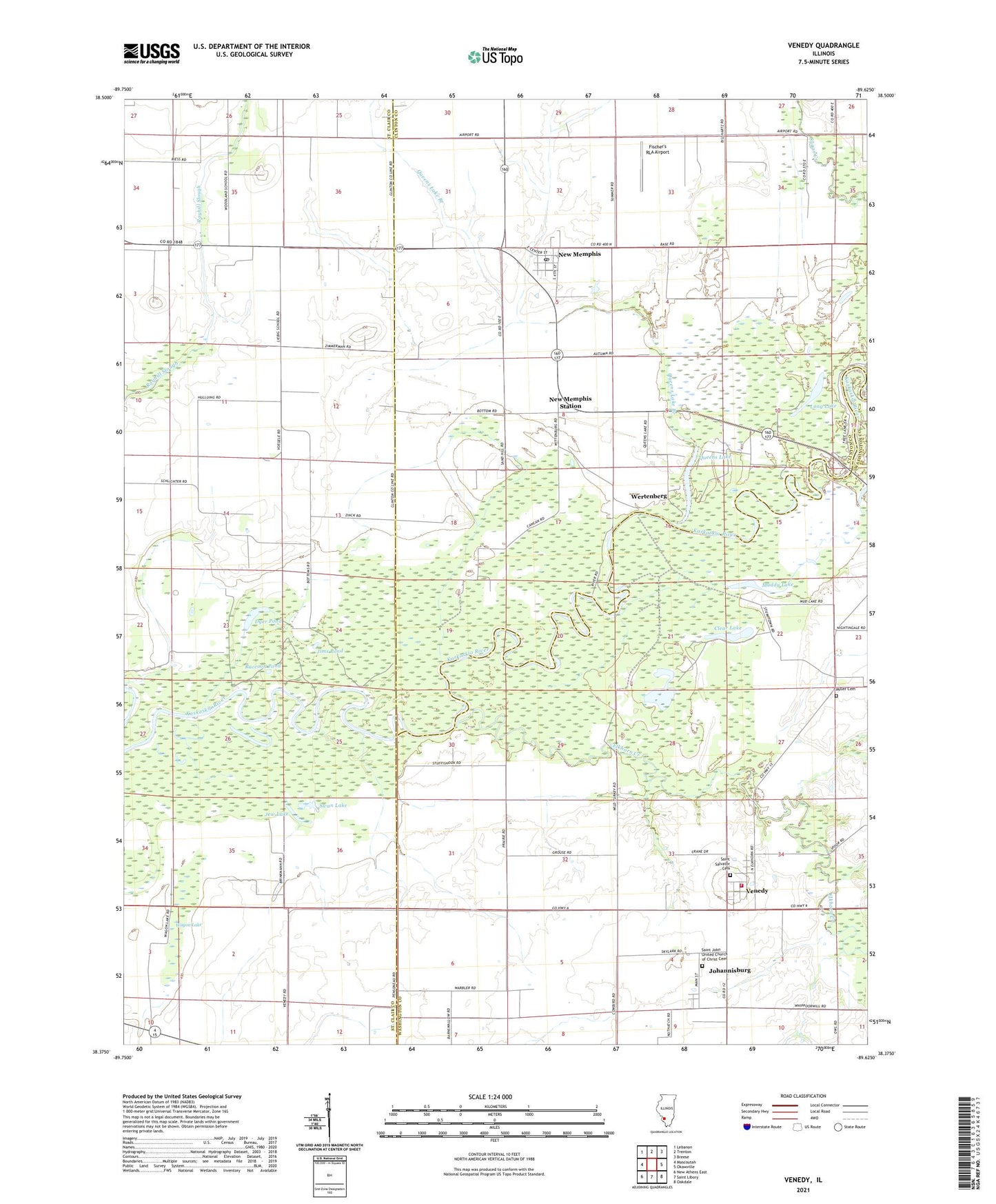
Venedy Illinois US Topo Map
Couldn't load pickup availability
2024 topographic map quadrangle Venedy in the state of Illinois. Scale: 1:24000. Based on the newly updated USGS 7.5' US Topo map series, this map is in the following counties: Clinton, St. Clair, Washington. The map contains contour data, water features, and other items you are used to seeing on USGS maps, but also has updated roads and other features. This is the next generation of topographic maps. Printed on high-quality waterproof paper with UV fade-resistant inks.
Quads adjacent to this one:
West: Mascoutah
Northwest: Lebanon
North: Trenton
Northeast: Breese
East: Okawville
Southeast: Oakdale
South: Saint Libory
Southwest: New Athens East
This map covers the same area as the classic USGS quad with code o38089d6.
Contains the following named places: Beer Dairy Farm, Calamus Lake, Clear Lake, Dyer Pond, Elkhorn Creek, Fischer's RLA Airport, Jew Lake, Jims Pond, Johannisburg, Long Lake, Miller Cemetery, Muddy Lake, New Memphis, New Memphis Post Office, New Memphis Station, Okawville Fire Protection District Venedy Station, Queens Lake, Queens Lake Branch, Queens Lake Station, Raccoon Pond, Saint John United Church of Christ Cemetery, Swan Lake, Township of Venedy, Venedy, Village of Venedy, Wagon Lake, Wertenberg, Woodland School, ZIP Codes: 62265, 62266