MyTopo
Fairbanks Indiana US Topo Map
Couldn't load pickup availability
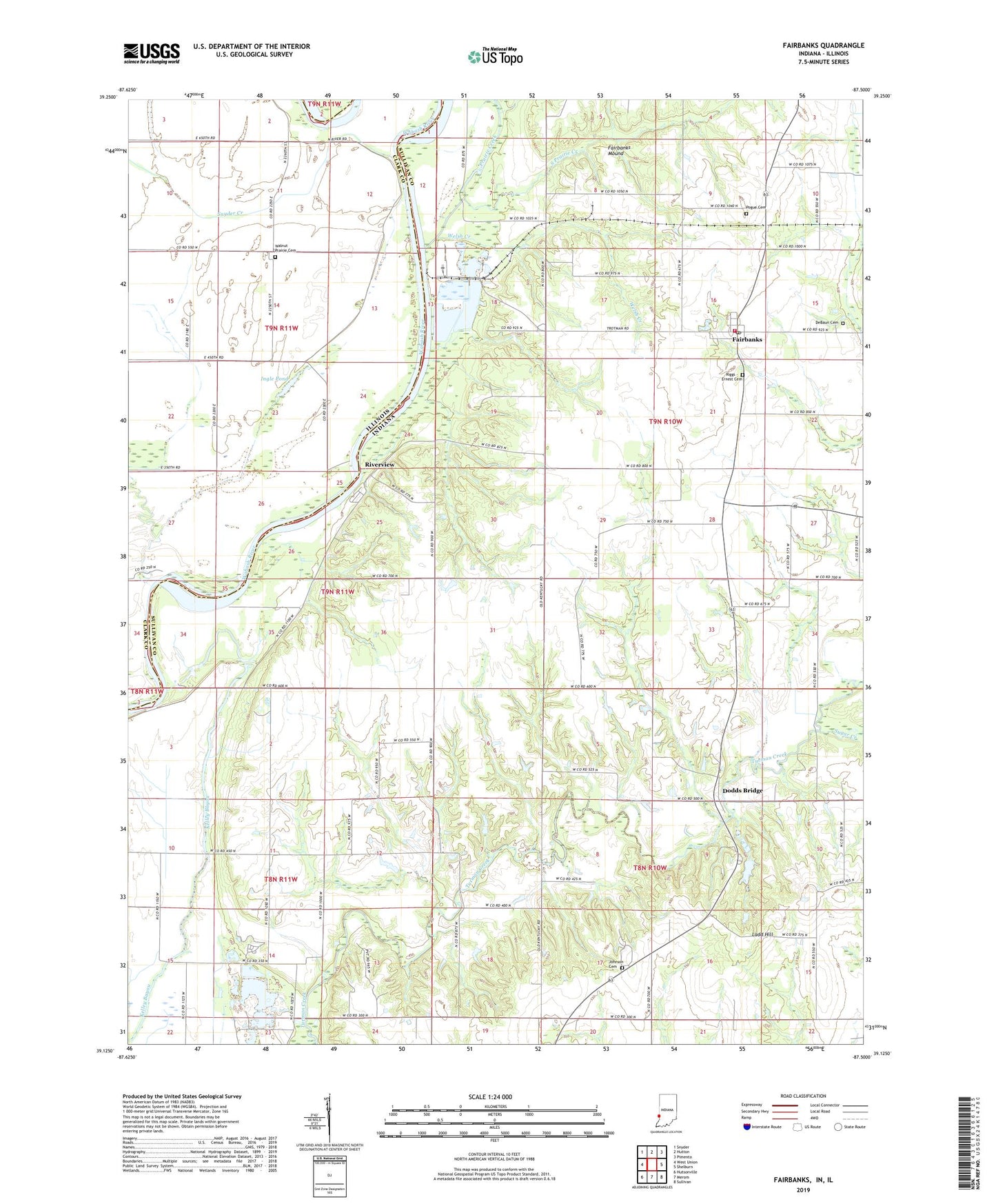
2022 topographic map quadrangle Fairbanks in the states of Indiana, Illinois. Scale: 1:24000. Based on the newly updated USGS 7.5' US Topo map series, this map is in the following counties: Sullivan, Clark. The map contains contour data, water features, and other items you are used to seeing on USGS maps, but also has updated roads and other features. This is the next generation of topographic maps. Printed on high-quality waterproof paper with UV fade-resistant inks.
Quads adjacent to this one:
West: West Union
Northwest: Snyder
North: Hutton
Northeast: Pimento
East: Shelburn
Southeast: Sullivan
South: Merom
Southwest: Hutsonville
This map covers the same area as the classic USGS quad with code o39087b5.
Contains the following named places: Brick United Methodist Church, DeBaun Cemetery, Dodds Bridge, Fairbanks, Fairbanks Elementary School, Fairbanks Mound, Fairbanks Post Office, Fairbanks Volunteer Fire Rescue, Graysville Pit, Ingle Pond, Johnson Cemetery, Kingsley Church, Ladd Hill, Long Pond, Missionary Church, Narrows Ferry, Pogue Cemetery, Prairie Creek, Riggs - Ernest Cemetery, Riverview, Roll-N-Ridge Airport, Snyder Creek, Sugar Creek, Township of Fairbanks, Township of Turman, Union Chapel, Walnut Prairie Cemetery, Welsh Creek, ZIP Code: 47849