MyTopo
Blackhawk Illinois US Topo Map
Couldn't load pickup availability
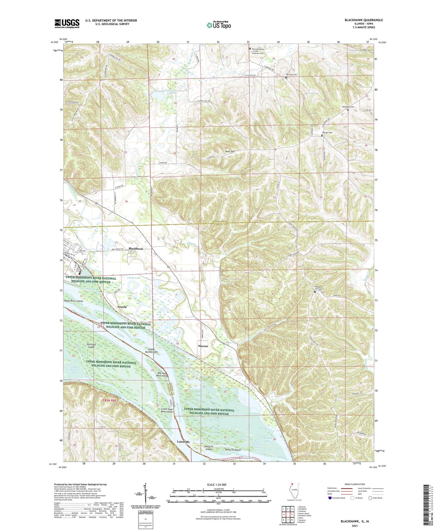
2024 topographic map quadrangle Blackhawk in the states of Illinois, Iowa. Scale: 1:24000. Based on the newly updated USGS 7.5' US Topo map series, this map is in the following counties: Carroll, Jo Daviess, Jackson. The map contains contour data, water features, and other items you are used to seeing on USGS maps, but also has updated roads and other features. This is the next generation of topographic maps. Printed on high-quality waterproof paper with UV fade-resistant inks.
Quads adjacent to this one:
West: Green Island
Northwest: Hanover
North: Elizabeth
Northeast: Stockton
East: Pleasant Valley
Southeast: Wacker
South: Savanna
Southwest: Miles
This map covers the same area as the classic USGS quad with code o42090b2.
Contains the following named places: Albright Cemetery, Apple River, Arnold, Arnold Landing, Big Soup Bone Island, Blackhawk, Buffalo Lake, Cheek Slough, Fitzgerald Lake, Fitzgerald Lake Dam-East Dam, Fitzgerald Lake West Dam, Gillispie School, Heer Hill, Hickory Slough, Holy Trinity Church, Horseshoe Lake, Island Number 259, Knapp School, Lainsville, Lainsville Slough, Little Rush Creek, Little Soup Bone Island, Lower Brown Lake, Lundy Lake, Marcus, Massbach Cemetery, Millers Lake, Mississippi Palisades State Park, Morrison Cemetery, Mosquito Hill Cemetery, Mosquito Hill School, NYA Camp, Oak Grove School, Oakland School, Oliver School, Palisades Country Club, Pinoak Lake, Railroad Island, Running Slough, Rush Creek, Saint Mathews Church, Santa Fe Beach, Santa Fe Island, Savanna Army Depot Activity Fire Station, Scarborough Lake, Sentinel Nature Preserve, Township of Derinda, Township of Washington, WCCI-FM (Savanna), West Hickory Lake, Woodland Valley Courts