MyTopo
Aberdeen Indiana US Topo Map
Couldn't load pickup availability
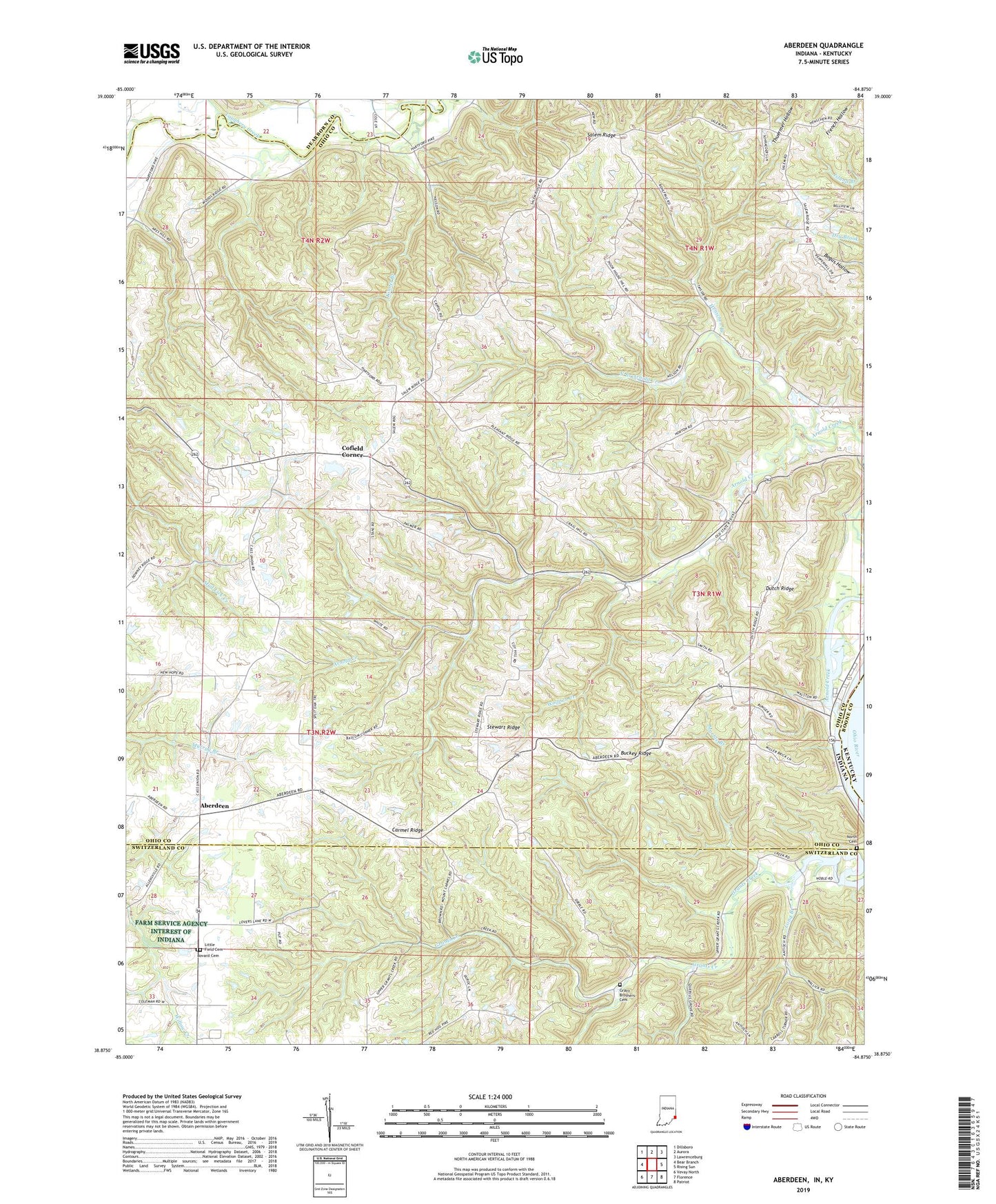
2022 topographic map quadrangle Aberdeen in the state of Indiana. Scale: 1:24000. Based on the newly updated USGS 7.5' US Topo map series, this map is in the following counties: Ohio, Switzerland, Dearborn, Boone. The map contains contour data, water features, and other items you are used to seeing on USGS maps, but also has updated roads and other features. This is the next generation of topographic maps. Printed on high-quality waterproof paper with UV fade-resistant inks.
Quads adjacent to this one:
West: Bear Branch
Northwest: Dillsboro
North: Aurora
Northeast: Lawrenceburg
East: Rising Sun
Southeast: Patriot
South: Florence
Southwest: Vevay North
Contains the following named places: Aberdeen, Arnold Creek, Bascom Corner, Bovard Cemetery, Buckey Ridge, Carmel Ridge, Cass Union School, Cofield Corner, Dutch Ridge, Grant Brothers Cemetery, Grants Creek Church, Hartford, Henschen Branch, Herbs Field, Kinnet Branch, Little Field Cemetery, Marble Branch, Mount Carmel Church, Mount Pleasant Church, North Branch Arnold Creek, North Cemetery, Ohio County, Pleasant Ridge Church, Rising Sun Airport, Salem Church, Salem Ridge, Stewart Ridge, Sycamore Church, Township of Cass, Township of Randolph, Township of Union, Wolfpen Creek, WSCH-FM (Aurora), ZIP Code: 47040