MyTopo
Bear Branch Indiana US Topo Map
Couldn't load pickup availability
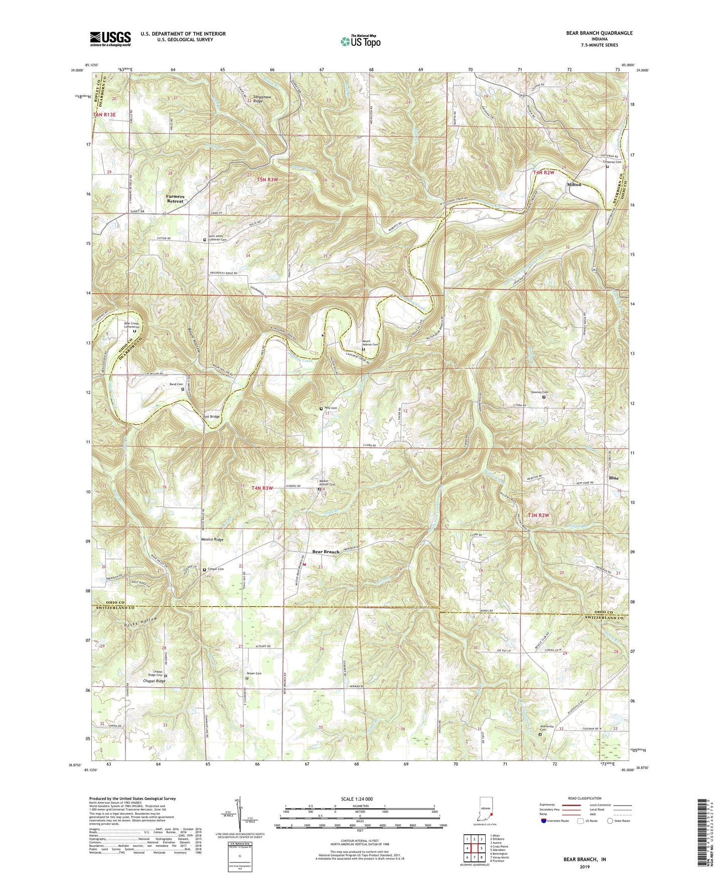
2022 topographic map quadrangle Bear Branch in the state of Indiana. Scale: 1:24000. Based on the newly updated USGS 7.5' US Topo map series, this map is in the following counties: Ohio, Dearborn, Switzerland, Ripley. The map contains contour data, water features, and other items you are used to seeing on USGS maps, but also has updated roads and other features. This is the next generation of topographic maps. Printed on high-quality waterproof paper with UV fade-resistant inks.
Quads adjacent to this one:
West: Cross Plains
Northwest: Milan
North: Dillsboro
Northeast: Aurora
East: Aberdeen
Southeast: Florence
South: Vevay North
Southwest: Bennington
This map covers the same area as the classic USGS quad with code o38085h1.
Contains the following named places: Allensville Cemetery, Baum Hollow, Bear Branch, Bear Branch Volunteer Fire Department, Bear Creek, Bear Creek Cemeteries, Bell Branch, Blue, Bobb Branch, Boyd Branch, Chapel Ridge, Chapel Ridge Cemetery, Conaway Cemetery, Cooper Cemetery, Daniel D Bray Lake, Daniel D Bray Lake Dam, Downey Cemetery, Downey Corner, Droege Creek, Dry Branch, Elk Creek, Farmers Retreat, Freedom School, Goodpasture Branch, Guionsville Post Office, Hayes Branch, Knigga Branch, Logson Branch, Long Branch, Lost Bridge, Marker - Althoff Cemetery, Mexico Ridge, Milton, Mire Branch, Mount Hebron Cemetery, Mud Lick, Mud Lick Creek, Murray Branch, New Hope Church, Olive Branch Church, Pate Cemetery, Pelser Cemetery, Posky Hollow, Pruss Airport, Rand Cemetery, Saint Johns Lutheran Cemetery, Saint Johns School, Saint Peters Church, South Fork Laughery Creek, Sugar Branch, Township of Caesar Creek, Township of Pike, Willow Creek, ZIP Codes: 47011, 47018