MyTopo
Aurora Indiana US Topo Map
Couldn't load pickup availability
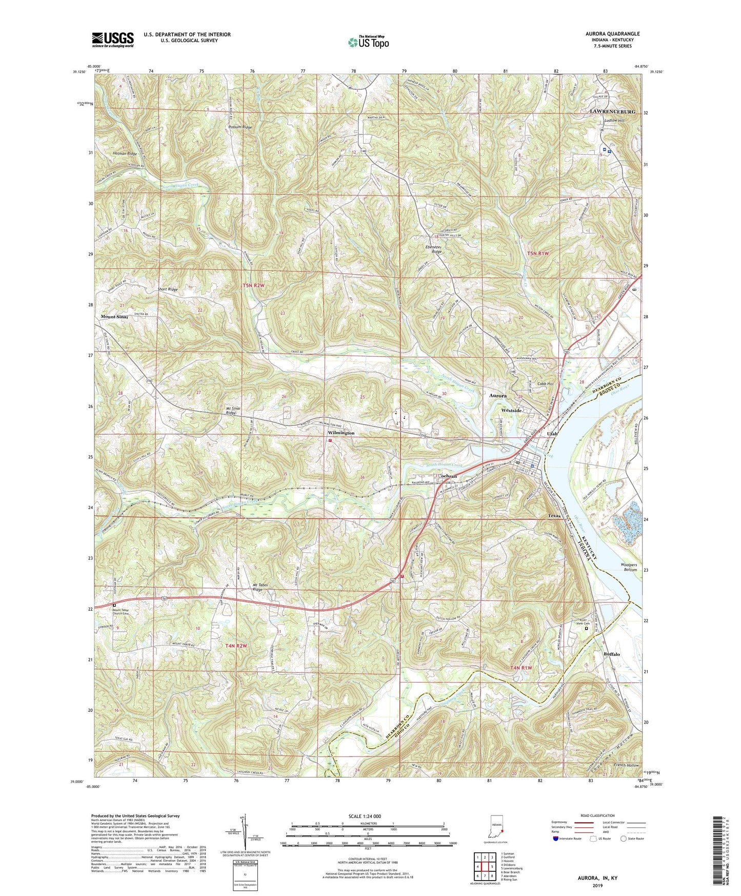
2022 topographic map quadrangle Aurora in the states of Indiana, Kentucky. Scale: 1:24000. Based on the newly updated USGS 7.5' US Topo map series, this map is in the following counties: Dearborn, Ohio, Boone. The map contains contour data, water features, and other items you are used to seeing on USGS maps, but also has updated roads and other features. This is the next generation of topographic maps. Printed on high-quality waterproof paper with UV fade-resistant inks.
Quads adjacent to this one:
West: Dillsboro
Northwest: Sunman
North: Guilford
Northeast: Hooven
East: Lawrenceburg
Southeast: Rising Sun
South: Aberdeen
Southwest: Bear Branch
Contains the following named places: Allen Branch, Aurora, Aurora Casket Company Airport, Aurora Elementary School, Aurora Emergency Rescue Services, Aurora Ferry, Aurora Fire Department, Aurora Middle School, Aurora Police Department, Aurora Post Office, Buffalo, City of Aurora, Cobb Hill, Cochran, Community Mental Health Center, Dearborn Country Club, Ebenezer Church, Ebenezer Ridge, Elk Run, Goose Run, Highpoint Health Hospital, Hogan Creek, Hogan Township Volunteer Fire Department, Kirschs Corner, Laughery Creek, Lawrenceburg Fire Department Station 2, Lawrenceburg Post Office, Little Hogan Creek, Ludlow Church, Mount Sinai, Mount Sinai Church, Mount Tabor Church Cemetery, North Hogan Creek, River View Cemetery, Short Ridge, South Dearborn High School, Texas, Thuermer Hollow, Township of Center, Township of Hogan, Township of Washington, Utah, Westside, Wilmington, Wilson Creek, Woolpers Bottom, ZIP Code: 47001