MyTopo
Auburn Indiana US Topo Map
Couldn't load pickup availability
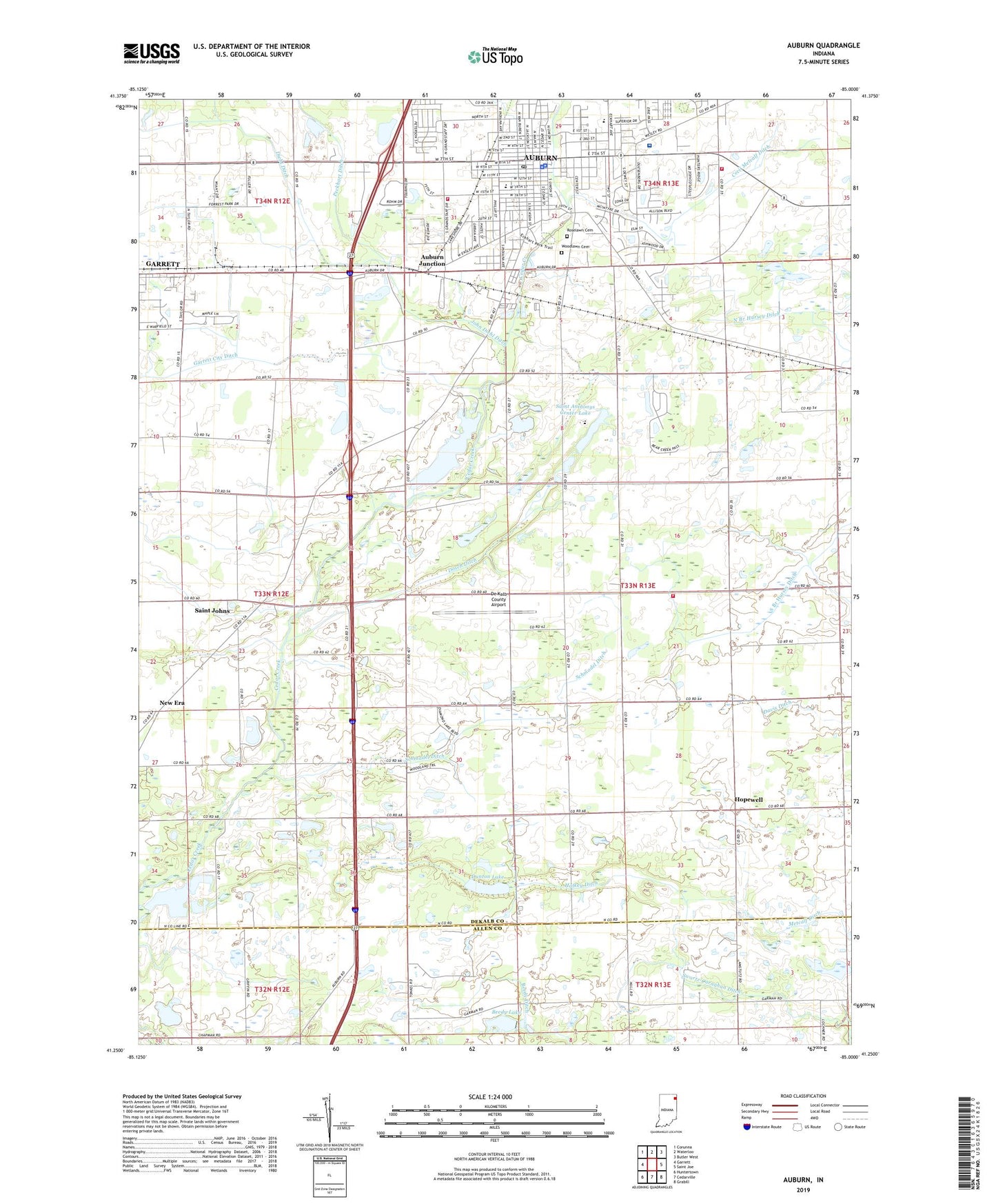
2022 topographic map quadrangle Auburn in the state of Indiana. Scale: 1:24000. Based on the newly updated USGS 7.5' US Topo map series, this map is in the following counties: DeKalb, Allen. The map contains contour data, water features, and other items you are used to seeing on USGS maps, but also has updated roads and other features. This is the next generation of topographic maps. Printed on high-quality waterproof paper with UV fade-resistant inks.
Quads adjacent to this one:
West: Garrett
Northwest: Corunna
North: Waterloo
Northeast: Butler West
East: Saint Joe
Southeast: Grabill
South: Cedarville
Southwest: Huntertown
This map covers the same area as the classic USGS quad with code o41085c1.
Contains the following named places: Auburn, Auburn Fire Department, Auburn Fire Department Station 1, Auburn Fire Department Station 2, Auburn Junction, Auburn Police Department, Auburn Post Office, Beedy Ditch, Beedy Lake, Beedy Lake Dam, Carr Field, Cecil Metcalf Ditch, City of Auburn, City of Garrett, County Line Church, De Kalb County Airport, De Kalb County Sheriff, Dekalb Health Hospital, Desoto Park, Dosch Ditch, Dunton Lake, East Auburn Elementary School, Garrett Ditch, Halkey Ditch, Hopewell, Jackson Township Fire Department, John Diehl Ditch, McKenney Harrison Elementary School, Meese Church, Memorial Park, Mooney Field, New Era, Northeastern Center, Riley Park, Roselawn Cemetery, Saint Anthonys Center Lake, Saint Anthonys Center Lake Dam, Saint Johns, Salem Church, Schmadel Ditch, Swartz-Carnahan Ditch, Thomas Park, Township of Jackson, WIFF-AM (Auburn), WIFF-FM (Auburn), Woodlawn Cemetery, ZIP Code: 46706