MyTopo
Waterloo Indiana US Topo Map
Couldn't load pickup availability
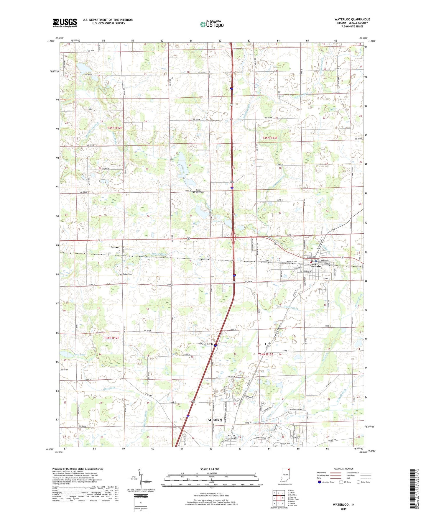
2022 topographic map quadrangle Waterloo in the state of Indiana. Scale: 1:24000. Based on the newly updated USGS 7.5' US Topo map series, this map is in the following counties: DeKalb. The map contains contour data, water features, and other items you are used to seeing on USGS maps, but also has updated roads and other features. This is the next generation of topographic maps. Printed on high-quality waterproof paper with UV fade-resistant inks.
Quads adjacent to this one:
West: Corunna
Northwest: Stroh
North: Ashley
Northeast: Hamilton
East: Butler West
Southeast: Saint Joe
South: Auburn
Southwest: Garrett
This map covers the same area as the classic USGS quad with code o41085d1.
Contains the following named places: Auburn Golf Club, Brand Sand Pit, Cedar Lake, Cedar Lake Cemetery, Cedar Lake Church, Dekalb High School, Dekalb Junior High School, Dibbling Ditch, Hoffelder Ditch, Leins Ditch, Lintz Lake, Maple Grove Church, Matson Ditch, Mott Cemetery, Ober Ditch, Peckhart Ditch, Pleasant Chapel, Saint Michaels Church, Sedan, Sedan Cemetery, Swartz Ditch, Tamarack Cemetery, Town of Waterloo, Township of Grant, Township of Smithfield, Township of Union, Trinity Church, Waterloo, Waterloo Elementary School, Waterloo Grant Township Volunteer Fire Department, Waterloo Police Department, Waterloo Post Office, ZIP Code: 46793