MyTopo
Butler West Indiana US Topo Map
Couldn't load pickup availability
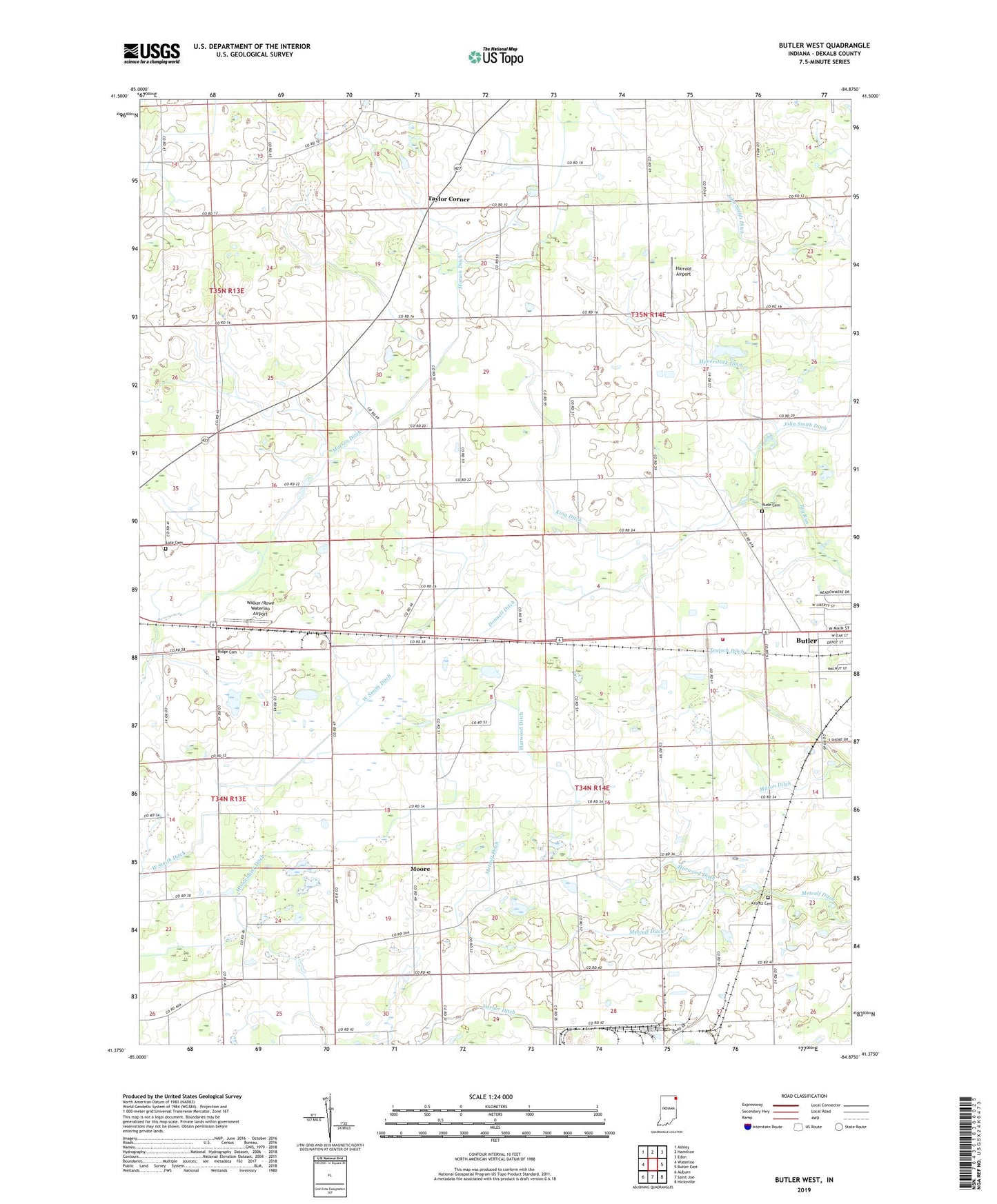
2022 topographic map quadrangle Butler West in the state of Indiana. Scale: 1:24000. Based on the newly updated USGS 7.5' US Topo map series, this map is in the following counties: DeKalb. The map contains contour data, water features, and other items you are used to seeing on USGS maps, but also has updated roads and other features. This is the next generation of topographic maps. Printed on high-quality waterproof paper with UV fade-resistant inks.
Quads adjacent to this one:
West: Waterloo
Northwest: Ashley
North: Hamilton
Northeast: Edon
East: Butler East
Southeast: Hicksville
South: Saint Joe
Southwest: Auburn
This map covers the same area as the classic USGS quad with code o41084d8.
Contains the following named places: Butler Fire Department, DeKalb County, Donnell Ditch, Franklin Center School, Harrold Airport, Harwood Ditch, Haverstock Ditch, Hoodelmier Ditch, King Ditch, Krontz Cemetery, Lutz Cemetery, Mason Ditch, Matson Ditch, Metcalf Ditch, Moore, Mount Pleasant Church, Norris Chapel, Ridge Cemetery, Rude Cemetery, Taylor Corner, Teutsch Ditch, Township of Franklin, Township of Wilmington, Varner Ditch, W Smith Ditch, Walker/Rowe Waterloo Airport, ZIP Code: 46721