MyTopo
Saint Joe Indiana US Topo Map
Couldn't load pickup availability
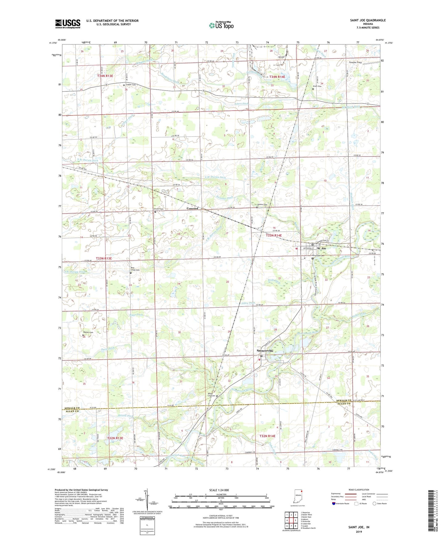
2022 topographic map quadrangle Saint Joe in the state of Indiana. Scale: 1:24000. Based on the newly updated USGS 7.5' US Topo map series, this map is in the following counties: DeKalb, Allen. The map contains contour data, water features, and other items you are used to seeing on USGS maps, but also has updated roads and other features. This is the next generation of topographic maps. Printed on high-quality waterproof paper with UV fade-resistant inks.
Quads adjacent to this one:
West: Auburn
Northwest: Waterloo
North: Butler West
Northeast: Butler East
East: Hicksville
Southeast: Woodburn North
South: Grabill
Southwest: Cedarville
This map covers the same area as the classic USGS quad with code o41084c8.
Contains the following named places: Bear Creek, Bear Creek Cemetery, Carper Ditch, Concord, Concord Cemetery, Concord Township Fire Department, Cosper Cemetery, D D Metcalf Ditch, Davis Ditch, Dilley Ditch, Fisher Ditch, Hindman Ditch, Jenkins Cemetery, Kraft Cemetery, Metcalf Ditch, North Branch Hursey Ditch, Riggs Ditch, Riverdale Elementary School, Riverdale High School, Riverside Cemetery, Saint Joe, Saint Joe Post Office, Sebert Ditch, Sol Shank Ditch, South Branch Hursey Ditch, Spencerville, Spencerville Fire Department, Spencerville Pit, Spencerville Post Office, Swander Ditch, Town of Saint Joe, Township of Concord, Township of Spencer, Union Chapel, Wade Ditch, Watson Cemetery, Weicht Ditch, White City Cemetery, Wingard Ditch, ZIP Codes: 46785, 46788