MyTopo
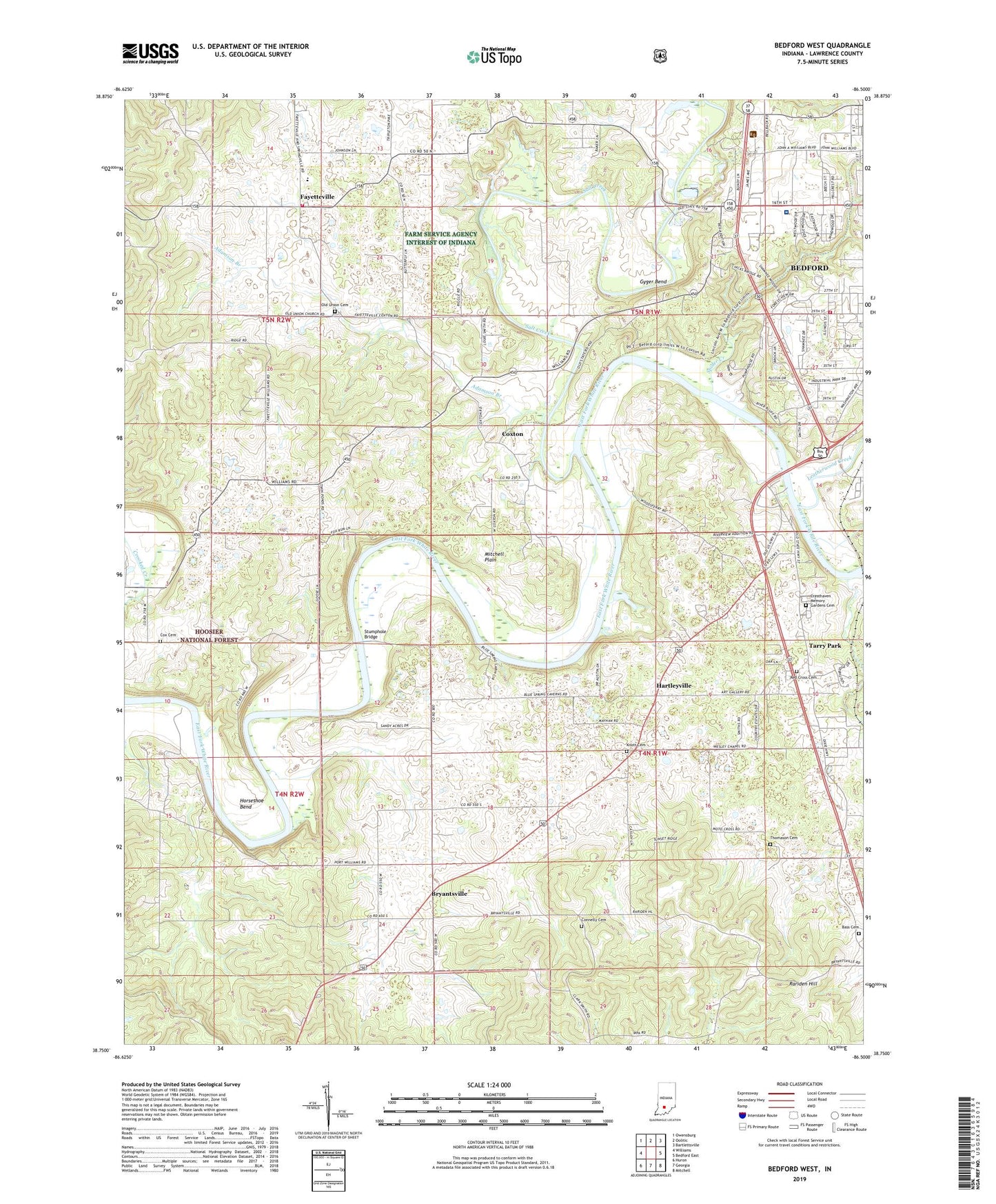
Bedford West Indiana US Topo Map
Couldn't load pickup availability
Also explore the Bedford West Forest Service Topo of this same quad for updated USFS data
2022 topographic map quadrangle Bedford West in the state of Indiana. Scale: 1:24000. Based on the newly updated USGS 7.5' US Topo map series, this map is in the following counties: Lawrence. The map contains contour data, water features, and other items you are used to seeing on USGS maps, but also has updated roads and other features. This is the next generation of topographic maps. Printed on high-quality waterproof paper with UV fade-resistant inks.
Quads adjacent to this one:
West: Williams
Northwest: Owensburg
North: Oolitic
Northeast: Bartlettsville
East: Bedford East
Southeast: Mitchell
South: Georgia
Southwest: Huron
This map covers the same area as the classic USGS quad with code o38086g5.
Contains the following named places: 4-H Club Fairground, Adamson Branch, Bass Cemetery, Bedford Fire Department Englewood Station, Bedford Fire Department Station 3 Englewood, Bedford Quarry, Bryantsville, Connelly Cemetery, Cox Cemetery, Coxton, Cresthaven Memory Gardens Cemetery, Eureka, Fayetteville, Gyger Bend, Hartleyville, Horseshoe Bend, Indian Creek Volunteer Fire Department, Indiana University Health Bedford Hospital, Knott Cemetery, Leatherwood Creek, Mitchell Speedway, New Union Church, Old Union Cemetery, Old Union Church, Pearson Kaolin Mines, Rariden Hill, Red Cross Cemetery, Redding, Riverview, Salt Creek, Shiloh Church, Spider Creek, Stumphole Bridge, Tarry Park, Thomason Cemetery, Township of Indian Creek, Township of Spice Valley, Wesley Chapel