MyTopo
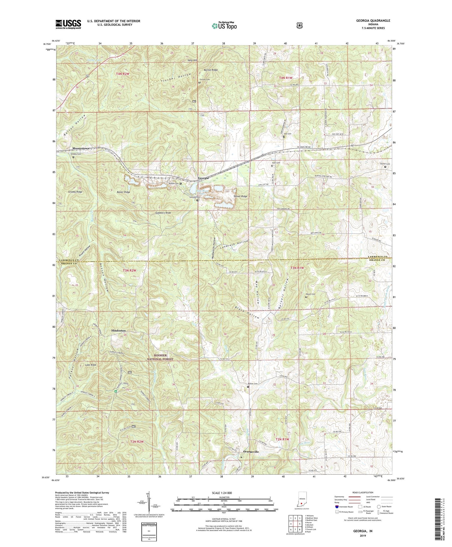
Georgia Indiana US Topo Map
Couldn't load pickup availability
Also explore the Georgia Forest Service Topo of this same quad for updated USFS data
2022 topographic map quadrangle Georgia in the state of Indiana. Scale: 1:24000. Based on the newly updated USGS 7.5' US Topo map series, this map is in the following counties: Lawrence, Orange. The map contains contour data, water features, and other items you are used to seeing on USGS maps, but also has updated roads and other features. This is the next generation of topographic maps. Printed on high-quality waterproof paper with UV fade-resistant inks.
Quads adjacent to this one:
West: Huron
Northwest: Williams
North: Bedford West
Northeast: Bedford East
East: Mitchell
Southeast: Paoli
South: French Lick
Southwest: Hillham
This map covers the same area as the classic USGS quad with code o38086f5.
Contains the following named places: Beech Grove Church, Benson Hollow, Bethel Cemetery, Bethel Church, Black Hollow, Bonds Chapel, Bosler Ridge, Burnett Hollow, Burton Cemetery, Burton Hollow, Burton Ridge, Dry Branch, Georgia, Georgia Cemetery, Gobblers Knob, Grodey Cemetery, Grodey Ridge, Hager Farms, Half Moon Lake, Hall Cemetery, Hindostan, Hindostan Falls Public Fishing Area, Isom Cemetery, Landreth Hollow, Liberty Church, Luke Knob, Mitchell Quarry, Moorestown, Mount Cemetery, Mount Horeb Church, Mount Horeb Drain, Orangeville, Pruett Hollow, Sally Hill, Shirley Creek Horsemans Camp, Spice Valley Church, Tincher Cemetery, Tincher Hollow, Tincher Lake, Toliver Ridge, Township of Orangeville, Wadsworth Hollow, Way Hollow, Wesley Chapel, ZIP Codes: 47446, 47469