MyTopo
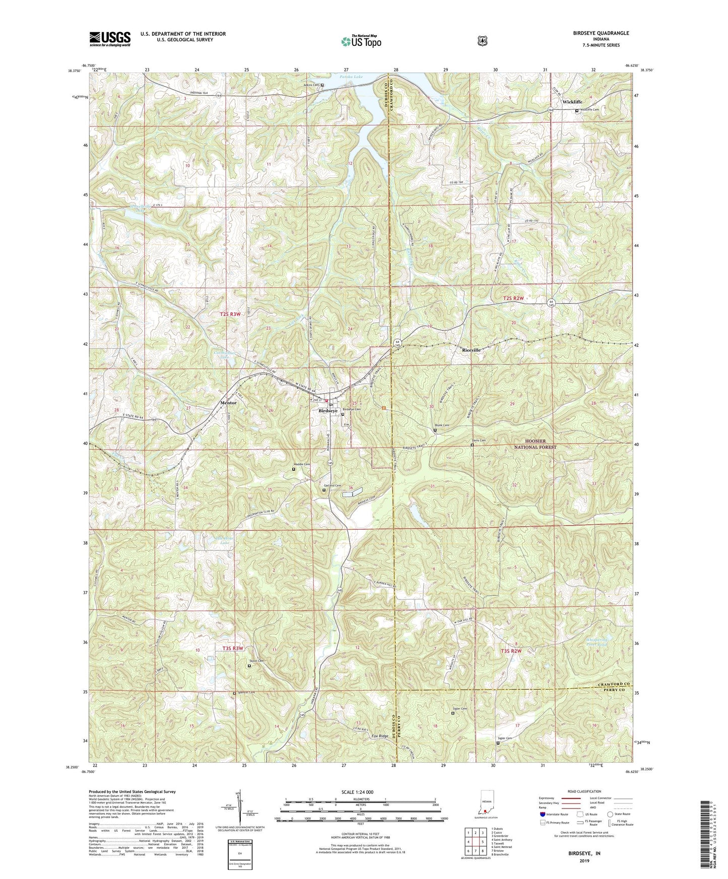
Birdseye Indiana US Topo Map
Couldn't load pickup availability
Also explore the Birdseye Forest Service Topo of this same quad for updated USFS data
2022 topographic map quadrangle Birdseye in the state of Indiana. Scale: 1:24000. Based on the newly updated USGS 7.5' US Topo map series, this map is in the following counties: Dubois, Crawford, Perry. The map contains contour data, water features, and other items you are used to seeing on USGS maps, but also has updated roads and other features. This is the next generation of topographic maps. Printed on high-quality waterproof paper with UV fade-resistant inks.
Quads adjacent to this one:
West: Saint Anthony
Northwest: Dubois
North: Cuzco
Northeast: Greenbrier
East: Taswell
Southeast: Branchville
South: Bristow
Southwest: Saint Meinrad
This map covers the same area as the classic USGS quad with code o38086c6.
Contains the following named places: Adkins Cemetery, Anderson Valley Church, Birdseye, Birdseye Cemetery, Birdseye Christian Church, Birdseye Post Office, Birdseye Volunteer Fire Department, Blunk Cemetery, Carmichael Lake, Carmichael Lake Dam, Davis Cemetery, Ditney Hill Post Office, Fox Ridge, Garland Cemetery, Idle Hour Lake, Idle Hour Lake Dam, Mentor, Mitchell Creek, Riceville, Riceville Creek, Saint Joe Church, Schnellville Conservation Lake Dam, Schnellville Lake, Sigler Cemetery, Spencer Cemetery, Taylor Cemetery, Taylor Hollow, Town of Birdseye, Township of Jefferson, Township of Johnson, Waddle Brook, Waddle Cemetery, Whispering Pines Pond, Wickliffe, Wickliffe Cemetery, ZIP Code: 47513