MyTopo
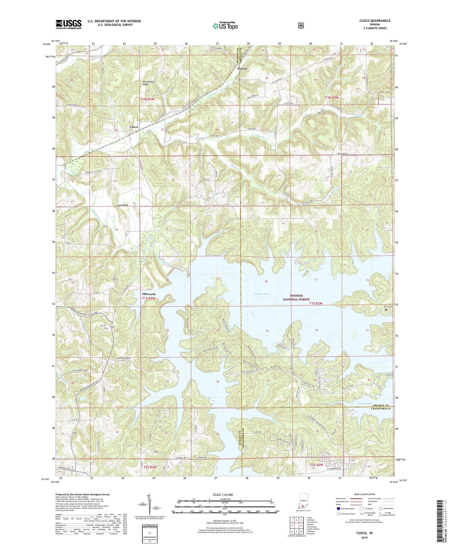
Cuzco Indiana US Topo Map
Couldn't load pickup availability
Also explore the Cuzco Forest Service Topo of this same quad for updated USFS data
2022 topographic map quadrangle Cuzco in the state of Indiana. Scale: 1:24000. Based on the newly updated USGS 7.5' US Topo map series, this map is in the following counties: Orange, Dubois, Crawford. The map contains contour data, water features, and other items you are used to seeing on USGS maps, but also has updated roads and other features. This is the next generation of topographic maps. Printed on high-quality waterproof paper with UV fade-resistant inks.
Quads adjacent to this one:
West: Dubois
Northwest: Rusk
North: Hillham
Northeast: French Lick
East: Greenbrier
Southeast: Taswell
South: Birdseye
Southwest: Saint Anthony
This map covers the same area as the classic USGS quad with code o38086d6.
Contains the following named places: Bender School, Cane Creek, Cane Creek Church, Cane Creek School, Cuzco, Dillon Creek, Ellsworth, Jackson State Recreation Area, Lick Fork, Lick Fork State Recreation Area, Lost Ridge, Newton-Stewart State Recreation Area, Norton, Painter Creek, Patoka Lake, Patoka Lake Dam, Persimmon Ridge, Ritter Creek, Southern Indiana Purdue Agriculture Center, Swift Cemetery, Township of Columbia, Township of Hall, Township of Jackson, ZIP Codes: 47432, 47521