MyTopo
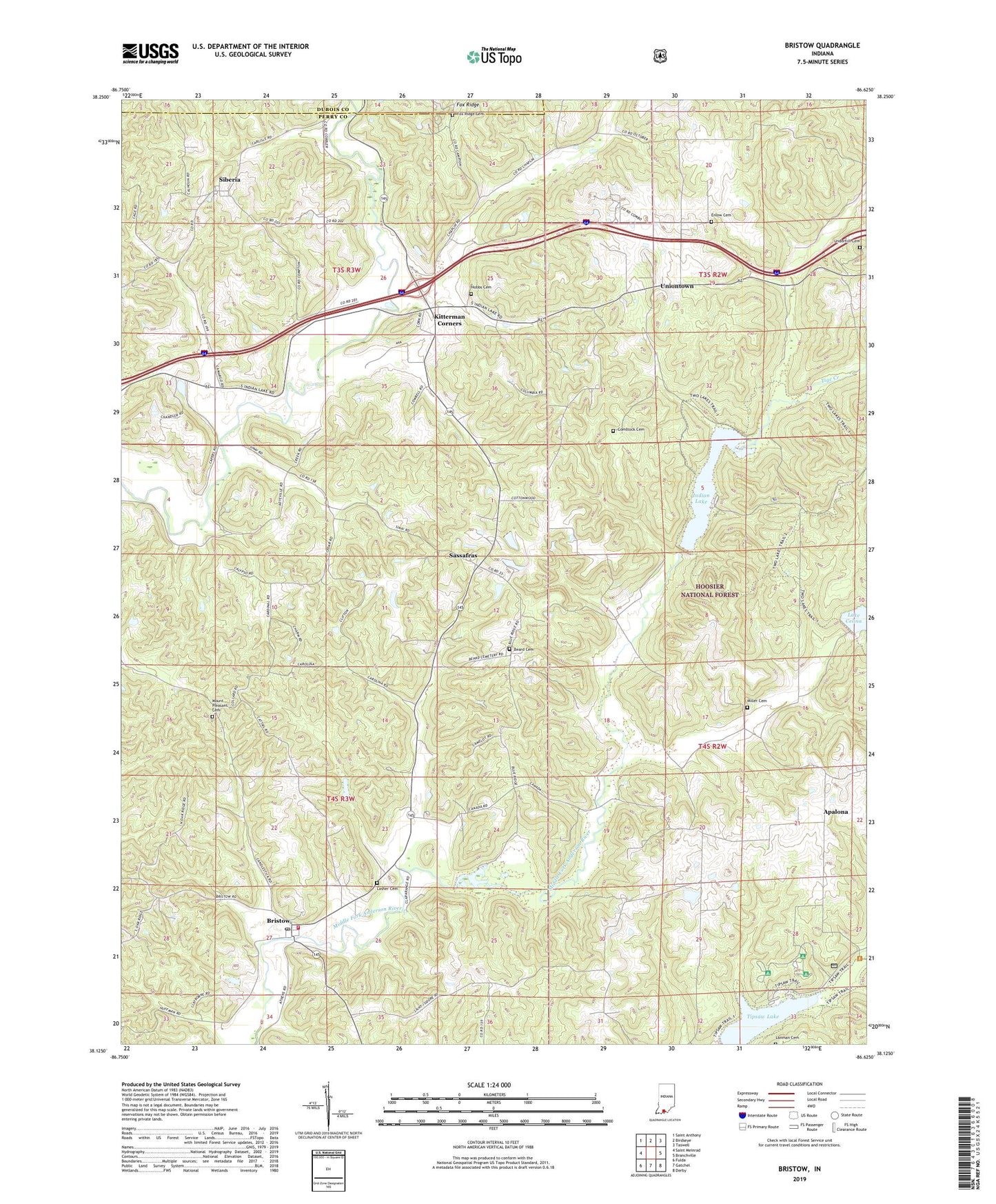
Bristow Indiana US Topo Map
Couldn't load pickup availability
Also explore the Bristow Forest Service Topo of this same quad for updated USFS data
2022 topographic map quadrangle Bristow in the state of Indiana. Scale: 1:24000. Based on the newly updated USGS 7.5' US Topo map series, this map is in the following counties: Perry, Dubois. The map contains contour data, water features, and other items you are used to seeing on USGS maps, but also has updated roads and other features. This is the next generation of topographic maps. Printed on high-quality waterproof paper with UV fade-resistant inks.
Quads adjacent to this one:
West: Saint Meinrad
Northwest: Saint Anthony
North: Birdseye
Northeast: Taswell
East: Branchville
Southeast: Derby
South: Gatchel
Southwest: Fulda
This map covers the same area as the classic USGS quad with code o38086b6.
Contains the following named places: Anderson Fire Department, Anderson Township Fire Department Station 2, Apalona, Beard Cemetery, Bristow, Bristow Post Office, Comstock Cemetery, Coon Branch, Dry Branch, Enlow Cemetery, Fosters Ridge, Fosters Ridge Church, Fox Ridge Cemetery, Hobbs Cemetery, Indian Lake, Indian Lake Recreation Area, Kitterman Corners, Lanman Cemetery, Lasher Cemetery, Maggity Branch, Massey Creek, Middle Fork Dam Number 5, Middle Fork Number 6 Dam, Middle Fork Number 7 Dam, Miller Cemetery, Mount Pleasant Cemetery, Mount Sinai Church, Oak Ridge Church, Saint Johns Church, Sassafras, Siberia, Sigler Creek, Snake Branch, Tige Creek, Tipsaw Lake, Township of Clark, Underhill Cemetery, Uniontown, Winding Branch, ZIP Code: 47515