MyTopo
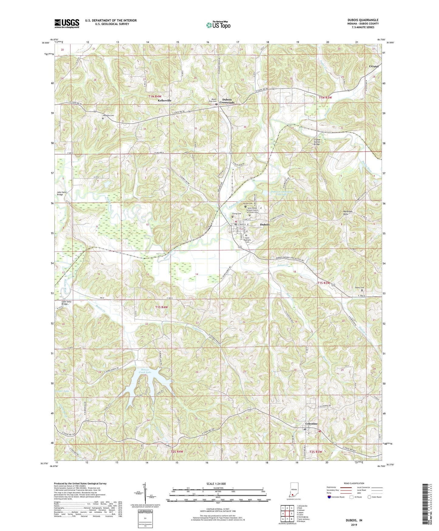
Dubois Indiana US Topo Map
Couldn't load pickup availability
Also explore the Dubois Forest Service Topo of this same quad for updated USFS data
2022 topographic map quadrangle Dubois in the state of Indiana. Scale: 1:24000. Based on the newly updated USGS 7.5' US Topo map series, this map is in the following counties: Dubois. The map contains contour data, water features, and other items you are used to seeing on USGS maps, but also has updated roads and other features. This is the next generation of topographic maps. Printed on high-quality waterproof paper with UV fade-resistant inks.
Quads adjacent to this one:
West: Jasper
Northwest: Alfordsville
North: Rusk
Northeast: Hillham
East: Cuzco
Southeast: Birdseye
South: Saint Anthony
Southwest: Huntingburg
This map covers the same area as the classic USGS quad with code o38086d7.
Contains the following named places: Bailey Cemetery, Bailey Creek, Bauer Creek, Beaver Creek, Beaver Creek Lake, Beaver Creek Lake Dam, Camp Carnes, Celestine, Celestine Community Club Lake, Celestine Community Club Lake Dam, Celestine Elementary School, Celestine Post Office, Celestine Volunteer Fire Department, Coon Seitz Bridge, Crystal, Crystal Station Bridge, Davis Creek, Dubois, Dubois Census Designated Place, Dubois Community Club Lake, Dubois Community Club Lake Dam, Dubois Crossroads, Dubois Post Office, Dubois Volunteer Fire Department, Ewing Cemetery, Harbison Cemetery, Harbison Hills, Hardin Cemetery, John Seitz Bridge, Kellerville, Ludlow Post Office, Mount Zion Cemetery, Northeast Dubois High School, Pinnick Creek, Polson Creek, Saint Johns Church, Saint Peters Church, Saint Peters United Church of Christ Cemetery, Saint Raphaels Cemetery, Saint Raphaels Church, Sugar Creek, Teder Creek, Township of Harbison, Township of Marion, ZIP Code: 47527