MyTopo
Bristol Indiana US Topo Map
Couldn't load pickup availability
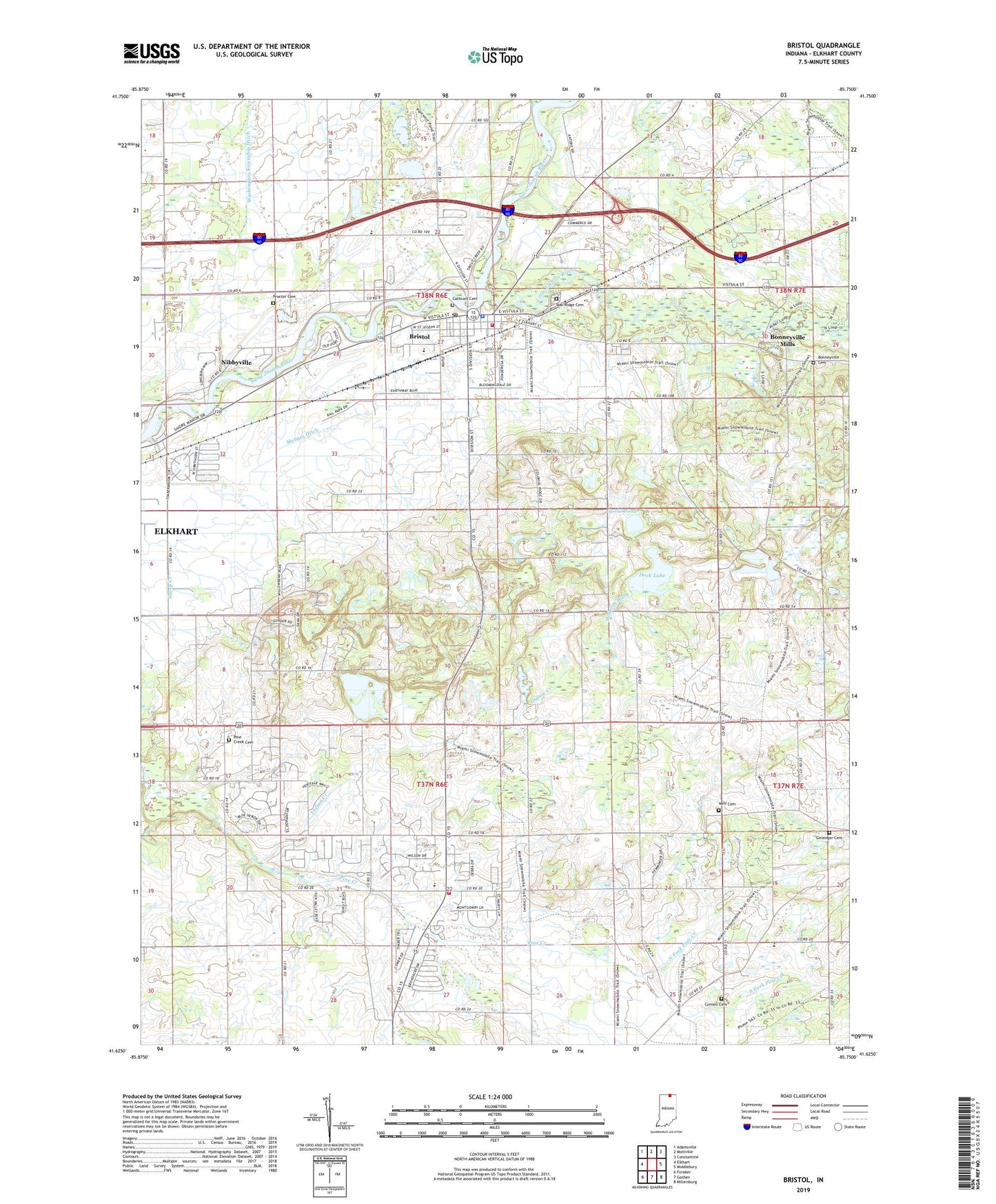
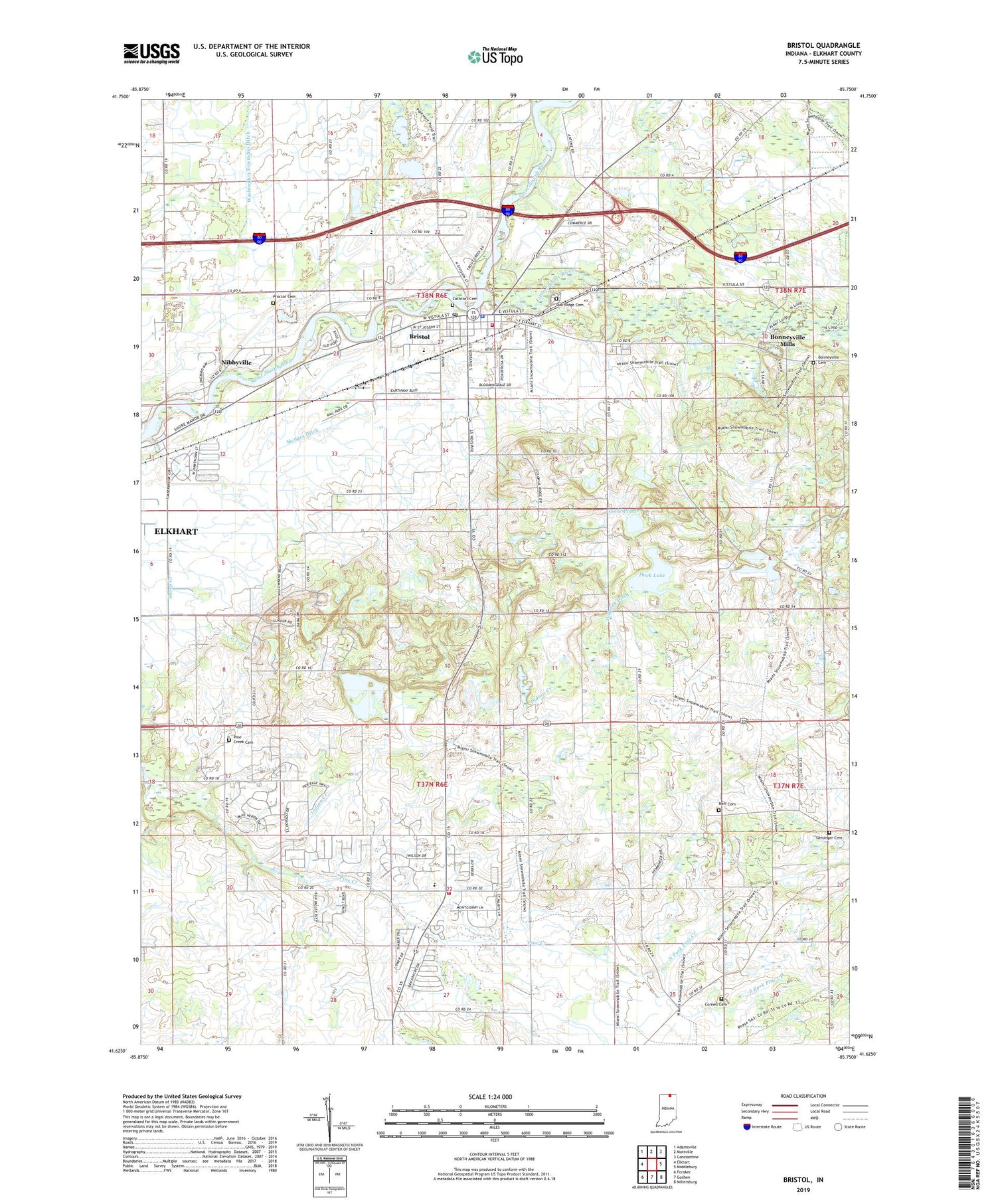
2022 topographic map quadrangle Bristol in the state of Indiana. Scale: 1:24000. Based on the newly updated USGS 7.5' US Topo map series, this map is in the following counties: Elkhart. The map contains contour data, water features, and other items you are used to seeing on USGS maps, but also has updated roads and other features. This is the next generation of topographic maps. Printed on high-quality waterproof paper with UV fade-resistant inks.
Quads adjacent to this one:
West: Elkhart
Northwest: Adamsville
North: Mottville
Northeast: Constantine
East: Middlebury
Southeast: Millersburg
South: Goshen
Southwest: Foraker
This map covers the same area as the classic USGS quad with code o41085f7.
Contains the following named places: Bonneyville Cemetery, Bonneyville Mills, Bristol, Bristol Elementary School, Bristol Fire Department, Bristol Police Dept, Bristol Post Office, Cathcart Cemetery, Cornell Cemetery, Dock Lake, Elcona Country Club, Geisinger Cemetery, Goose Pond, Harmony Acre Farm, Hatfield Airport, Hildreth Ditch, Hoobirk Farm, Indian Creek, Jefferson Township Fire Department, Kropf Airport, Lake Grange, Leann Acres, Little Elkhart River, Little Pine Church, Marlee Acres, Menges Ditch, Neff Cemetery, Nibbyville, North Fork Pine Creek, Oak Ridge Cemetery, Old Oak Farm, Pine Creek Cemetery, Pleasant Ridge Church, Pleasant View Church, Proctor Cemetery, Sheep Creek, South Fork Pine Creek, Town of Bristol, Township of Jefferson, Township of Washington, Trout Creek, Washington Township Ditch, Woodsbrook Farm, York Elementary School, York Township Ditch, ZIP Code: 46507