MyTopo
Middlebury Indiana US Topo Map
Couldn't load pickup availability
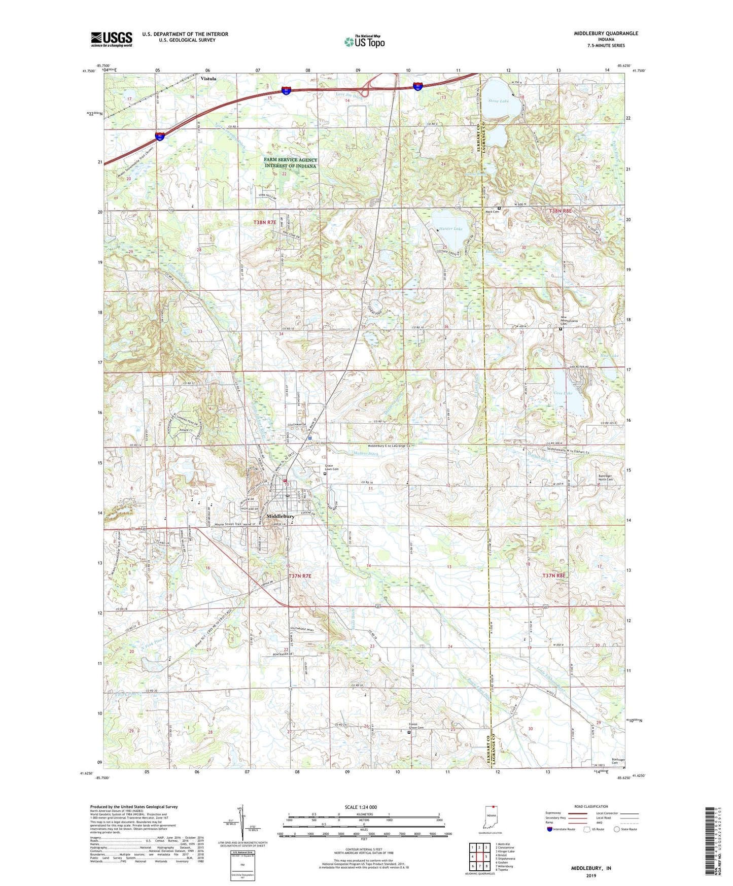
2022 topographic map quadrangle Middlebury in the state of Indiana. Scale: 1:24000. Based on the newly updated USGS 7.5' US Topo map series, this map is in the following counties: Elkhart, LaGrange. The map contains contour data, water features, and other items you are used to seeing on USGS maps, but also has updated roads and other features. This is the next generation of topographic maps. Printed on high-quality waterproof paper with UV fade-resistant inks.
Quads adjacent to this one:
West: Bristol
Northwest: Mottville
North: Constantine
Northeast: Klinger Lake
East: Shipshewana
Southeast: Topeka
South: Millersburg
Southwest: Goshen
This map covers the same area as the classic USGS quad with code o41085f6.
Contains the following named places: Bontrager Cemetery, Bontrager North Cemetery, Brokesha Lake, Cass Lake, Crystal Bend Farm, Crystal Valley Dairy Farm, Culver Duck Farms, Dogwood Hills Tree Farm, East Lake, East Lake Ditch, Faith Baptist Church, First Mennonite Church, First United Methodist Church of Middlebury, Forest Grove Cemetery, Forest Grove Dairy, Goose Pond, Grace Lawn Cemetery, Griner Mennonite Church, Heritage Intermediate School, Hunter Lake, Mack Cemetery, Mather Ditch, Mather Lateral, Mid River Farms, Middlebury, Middlebury Church of the Brethren, Middlebury Community Public Library, Middlebury Elementary School, Middlebury Police Department, Middlebury Post Office, Middlebury Township Fire and EMS Department, Mud Lake, My Brook Farm, New Pennsylvania Cemetery, Northridge High School, Pleasant Valley Church of the Brethren, Raber Farms, Roselawn Conservative Mennonite Church, Smeltzer Farms, Stone Lake, Stone Lake Community Church, Stoney - M Farm, Stutz Ditch, Sunny Brook Farms, Town of Middlebury, Township of Middlebury, Township of York, Vistula, Wayside Church, Yoder Farm, ZIP Code: 46540