MyTopo
Foraker Indiana US Topo Map
Couldn't load pickup availability
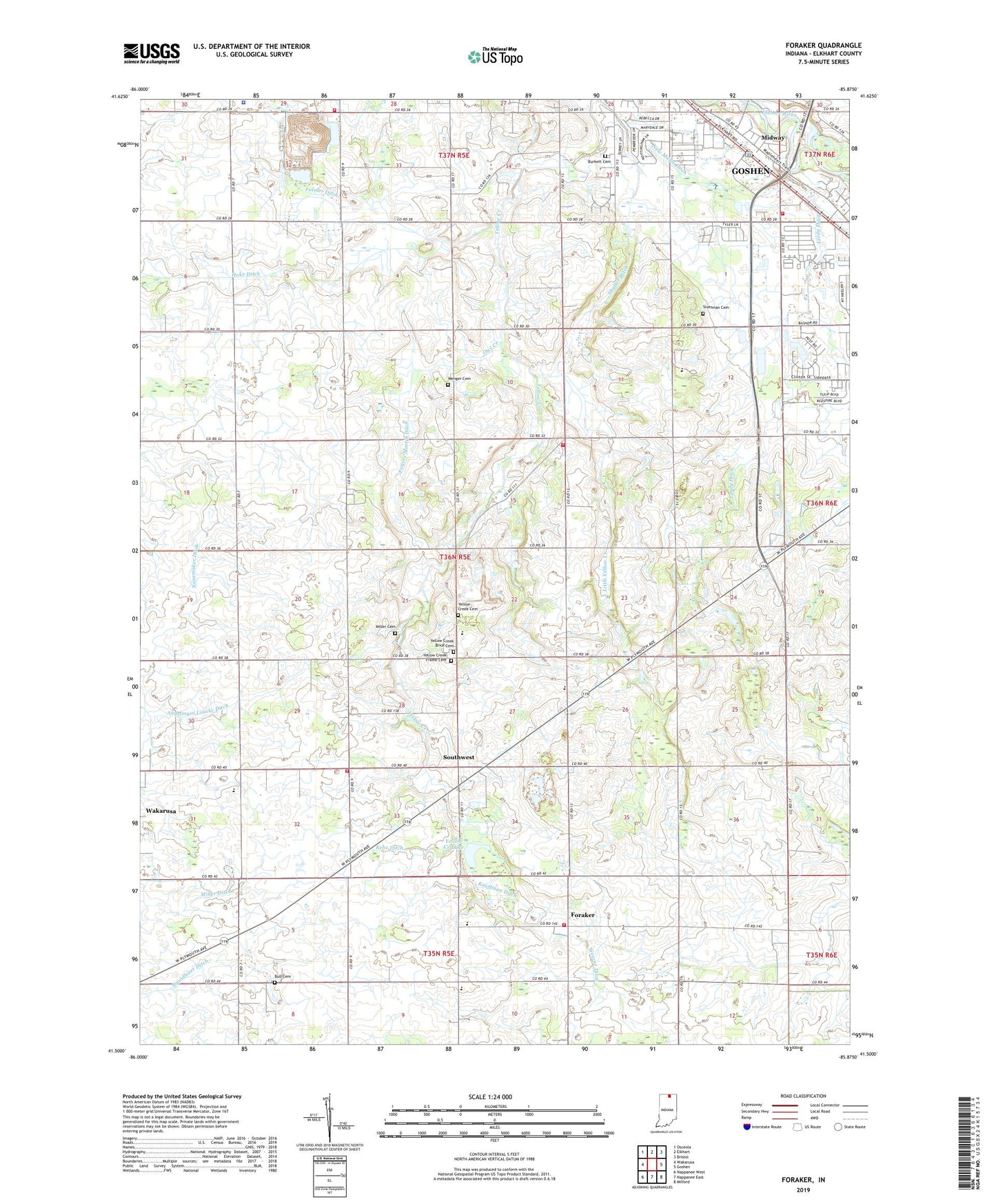
2022 topographic map quadrangle Foraker in the state of Indiana. Scale: 1:24000. Based on the newly updated USGS 7.5' US Topo map series, this map is in the following counties: Elkhart. The map contains contour data, water features, and other items you are used to seeing on USGS maps, but also has updated roads and other features. This is the next generation of topographic maps. Printed on high-quality waterproof paper with UV fade-resistant inks.
Quads adjacent to this one:
West: Wakarusa
Northwest: Osceola
North: Elkhart
Northeast: Bristol
East: Goshen
Southeast: Milford
South: Nappanee East
Southwest: Nappanee West
This map covers the same area as the classic USGS quad with code o41085e8.
Contains the following named places: Angelmyer Loucke Ditch, Bashor Childrens Home, Bethel Church, Bull Cemetery, Burkett Cemetery, Christner Gravel Pit, Concord Township Fire Department Station 2, Countryview Airport, Davidhizer Ditch, Doering Ditch, Ebenezer Church, Fetters Martin Ditch, Foraker, Foraker Fire Department, Fulmer Ditch, German Church, Goshen Fire Department Reliance Road Station, Harrison Elementary School, Harrison Township Fire Department Station 1, Harrison Township Volunteer Fire Department Station 1, Harrison Township Volunteer Fire Department Station 2, Hoke Ditch, Inbody Church, Kauffman Ditch, Kehr Ditch, Leedy Ditch, Little Yellow Creek, Martin Dairy Farms, Midway, Miller Cemetery, New Miller Ditch, Old Fundamental Church, Owl Creek, Quint Dairy, Saint Johns Church, Shaffer Ditch, Southwest, Stutsman Cemetery, Swoveland Ditch, Township of Harrison, WCMR-AM (Elkhart), Weaver Dairy Farm, Weaver Ditch, Wenger Cemetery, WFRN-FM (Elkhart), Wisler Church, WWCA-AM (Gary), Yellow Creek Brick Cemetery, Yellow Creek Cemetery, Yellow Creek Church, Yellow Creek Farm, Yellow Creek Frame Cemetery, Yellow Creek Lake, Zimmerman Greenhouse, ZIP Code: 46526