MyTopo
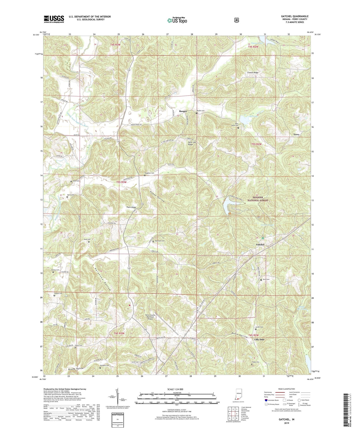
Gatchel Indiana US Topo Map
Couldn't load pickup availability
Also explore the Gatchel Forest Service Topo of this same quad for updated USFS data
2022 topographic map quadrangle Gatchel in the state of Indiana. Scale: 1:24000. Based on the newly updated USGS 7.5' US Topo map series, this map is in the following counties: Perry. The map contains contour data, water features, and other items you are used to seeing on USGS maps, but also has updated roads and other features. This is the next generation of topographic maps. Printed on high-quality waterproof paper with UV fade-resistant inks.
Quads adjacent to this one:
West: Fulda
Northwest: Saint Meinrad
North: Bristow
Northeast: Branchville
East: Derby
Southeast: Rome
South: Cannelton
Southwest: Tell City
This map covers the same area as the classic USGS quad with code o38086a6.
Contains the following named places: Anderson Township Fire Department, Bolin Hollow, Covey Cemetery, Davis Cemetery, Deer Creek Church, Dodson Cemetery, Don Juan Post Office, Frakes Cemetery, Gatchel, Gatchel Pond, Hammack Cemetery, Harpenau Hollow, Hicks Cemetery, Hogan Hollow, Howell School, Lamar Creek, Lilly Dale, Lilly Dale Church, Little Sulphur Creek, Lutgring Branch, Mackey Cemetery, Middle Deer Pond, Middle Fork Dam Number 1, Middle Fork Dam Number 2, Mill Lake, Niles Cemetery, Nixon Cemetery, Perry County, Perry County Municipal Airport, Ranger, Rhodes Cemetery, Richards Cemetery, Saddle Lake, Saddle Lake Recreation Area, Saint Joe Ridge, Saint Johns Cemetery, Saint Josephs Church, Saint Marks School, Sandy Branch, Slaughter Cemetery, Sulphur Fork Creek, Terry, Terry Cemetery, Theis Creek, Theis Ridge, Theis School, Tipsaw Lake, Township of Anderson, Wheatley Creek, Yoho Branch, ZIP Code: 47586