MyTopo
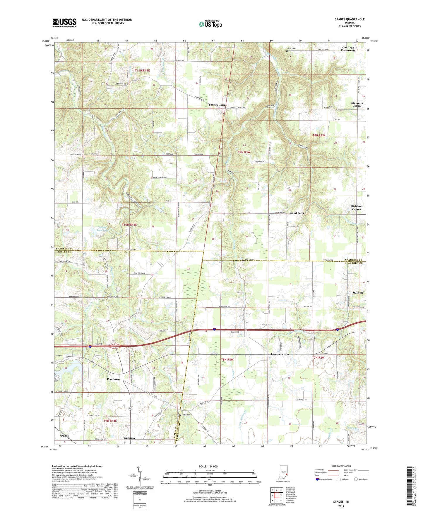
Spades Indiana US Topo Map
Couldn't load pickup availability
2022 topographic map quadrangle Spades in the state of Indiana. Scale: 1:24000. Based on the newly updated USGS 7.5' US Topo map series, this map is in the following counties: Franklin, Dearborn, Ripley. The map contains contour data, water features, and other items you are used to seeing on USGS maps, but also has updated roads and other features. This is the next generation of topographic maps. Printed on high-quality waterproof paper with UV fade-resistant inks.
Quads adjacent to this one:
West: Batesville
Northwest: Metamora
North: Brookville
Northeast: Whitcomb
East: Cedar Grove
Southeast: Guilford
South: Sunman
Southwest: Pierceville
This map covers the same area as the classic USGS quad with code o39085c1.
Contains the following named places: Alden Cemetery, East Fork Blue Creek, Freewill Church, Glasselly School, Highland Center, Klemmes Corner, Lawrenceville, Oak Tree Crossroads, Penntown, Peterson School, Pritog School, Russell Branch, Saint Jacobs Church, Saint Marys, Saint Peter, Saint Peters Church, Saint Stephens Church, Spades, Tall Oaks Lake, Tall Oaks Lake Dam, Township of Butler, Township of Highland, Township of Jackson, Trinity Church, Usher Cemetery, Usher School, Wayne Kopp Lake, Wayne Kopp Lake Dam, Western Creek, Youngs Corner, Yung Church