MyTopo
Carthage Indiana US Topo Map
Couldn't load pickup availability
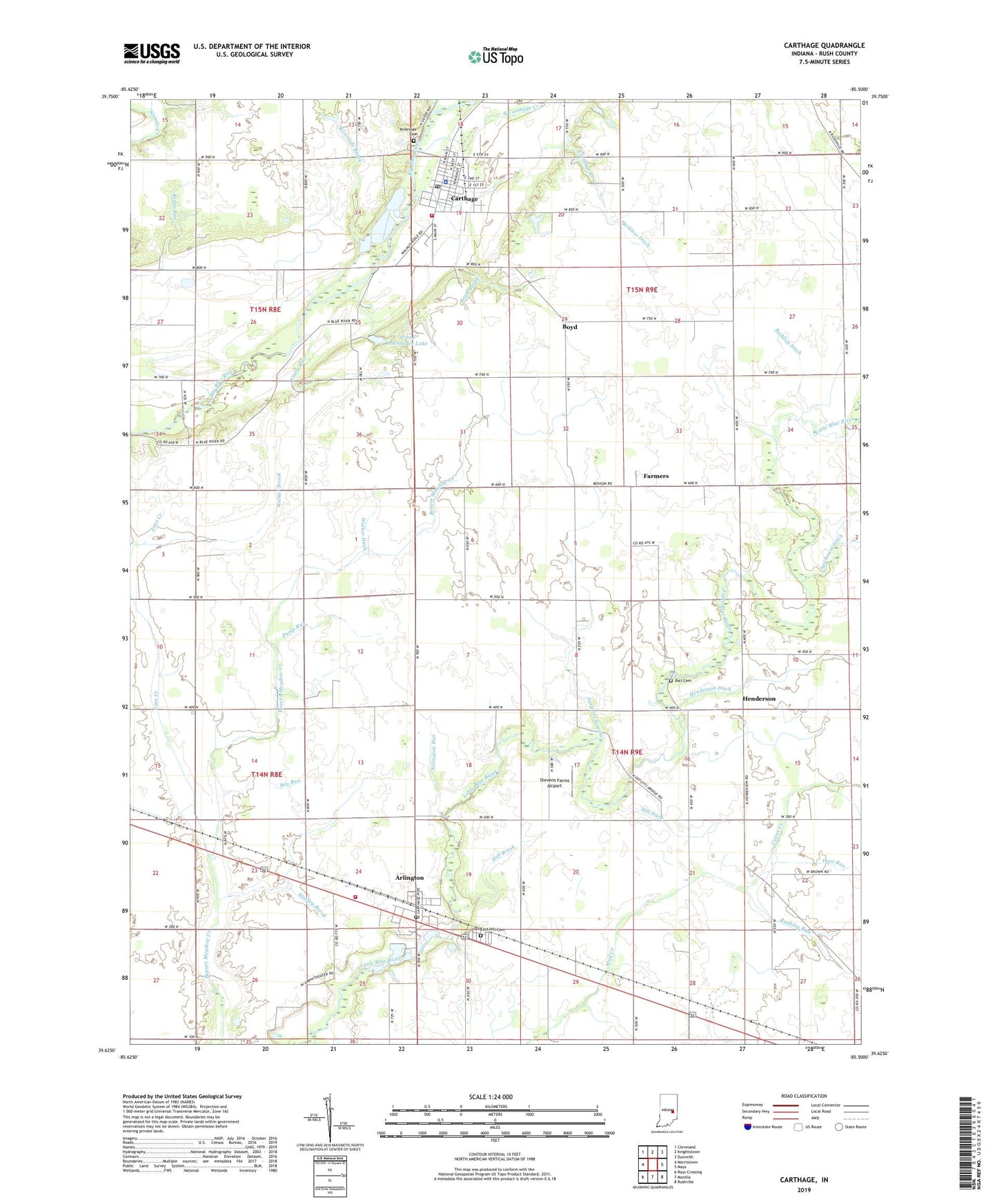
2022 topographic map quadrangle Carthage in the state of Indiana. Scale: 1:24000. Based on the newly updated USGS 7.5' US Topo map series, this map is in the following counties: Rush. The map contains contour data, water features, and other items you are used to seeing on USGS maps, but also has updated roads and other features. This is the next generation of topographic maps. Printed on high-quality waterproof paper with UV fade-resistant inks.
Quads adjacent to this one:
West: Morristown
Northwest: Cleveland
North: Knightstown
Northeast: Dunreith
East: Mays
Southeast: Rushville
South: Manilla
Southwest: Rays Crossing
This map covers the same area as the classic USGS quad with code o39085f5.
Contains the following named places: Arlington, Arlington Census Designated Place, Arlington East Hill Cemetery, Arlington Elementary School, Arlington Post Office, Arlington Run, Ball Cemetery, Ball Run, Bea Run, Boyd, Boyd Brook, Cap Run, Carthage, Carthage Creek, Carthage Elementary School, Carthage Police Department, Carthage Post Office, Carthage Volunteer Fire Department, Circle Run, Dill Ditch, Farmers, Farmers Stream, Fayette Central Elementary School, Frank Alexander Lake, Frank Alexander Lake Dam, Goose Creek, Hannegan Church, Henderson, Henderson Ditch, Herkless Ditch, Hill Brook, Linn Creek, Little Blue River Church, Miles Creek, Newhouse Ditch, North Carthage Creek, Osco Run, Posey Township Volunteer Fire Department, Pump Run, Reddick Ditch, Ripley Run, Riverside Brook, Riverside Cemetery, Rushing Run, Stanley Brook, Stevens Farms Airport, Town of Carthage, Township of Posey, Township of Ripley, Walker Brook, Walker Ditch, Walnut Ridge Church, Well Run, ZIP Codes: 46104, 46115