MyTopo
Cleveland Indiana US Topo Map
Couldn't load pickup availability
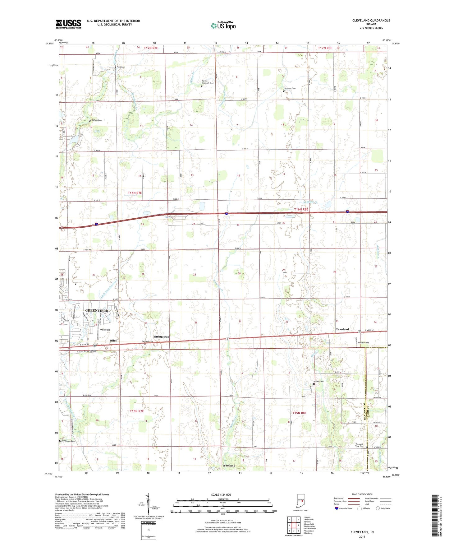
2022 topographic map quadrangle Cleveland in the state of Indiana. Scale: 1:24000. Based on the newly updated USGS 7.5' US Topo map series, this map is in the following counties: Hancock, Rush. The map contains contour data, water features, and other items you are used to seeing on USGS maps, but also has updated roads and other features. This is the next generation of topographic maps. Printed on high-quality waterproof paper with UV fade-resistant inks.
Quads adjacent to this one:
West: Greenfield
Northwest: Ingalls
North: Pendleton
Northeast: Shirley
East: Knightstown
Southeast: Carthage
South: Morristown
Southwest: Fountaintown
This map covers the same area as the classic USGS quad with code o39085g6.
Contains the following named places: Baptist - Braddock Cemetery, Barrett Cemetery, Browns Chapel, Caldwell Cemetery, Cleveland, Curry Chapel, Gilboa Cemetery, Greenfield Country Club, Hinchman Cemetery, Lost Forty Tree Farm, Nameless Creek Church, Oakes Field, Pleasant Hill, Pleasant View Cemetery, Pope Field, Pratt Cemetery, Riley, Simmons Cemetery, Stringtown, Township of Jackson, Westland, Willow Branch