MyTopo
Rushville Indiana US Topo Map
Couldn't load pickup availability
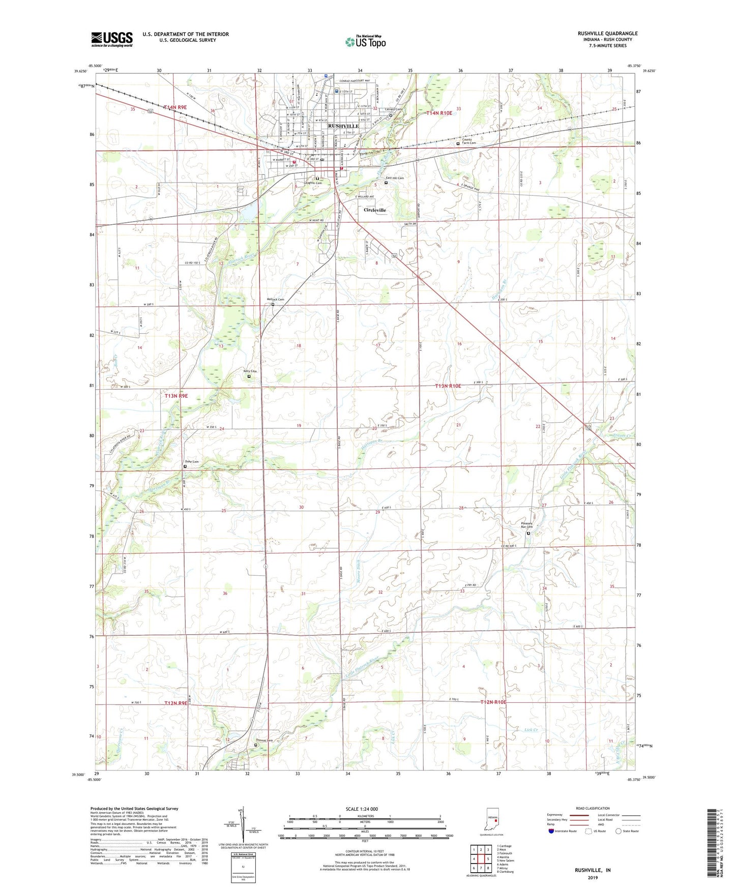
2022 topographic map quadrangle Rushville in the state of Indiana. Scale: 1:24000. Based on the newly updated USGS 7.5' US Topo map series, this map is in the following counties: Rush. The map contains contour data, water features, and other items you are used to seeing on USGS maps, but also has updated roads and other features. This is the next generation of topographic maps. Printed on high-quality waterproof paper with UV fade-resistant inks.
Quads adjacent to this one:
West: Manilla
Northwest: Carthage
North: Mays
Northeast: Falmouth
East: New Salem
Southeast: Clarksburg
South: Milroy
Southwest: Adams
This map covers the same area as the classic USGS quad with code o39085e4.
Contains the following named places: Air Evacuation Lifeteam - Rushville, Calvary Cemetery, Circleville, City of Rushville, County Farm Cemetery, D and R Airport, Duke Cemetery, East Hill Cemetery, Frazee Creek, Graham School, Gregg School, Harrigan Branch, Havens School, Kelly Cemetery, Laughlin Cemetery, Laughlin Park, Matlock Cemetery, Memorial Park, Moore Ditch, Pleasant Run Cemetery, Rush County, Rush Memorial Hospital, Rushville, Rushville Consolidated High School, Rushville Fire Department, Rushville Police Department, Rushville Post Office, Rushville Township Volunteer Fire Department, Saint Mary Elementary School, Thomas Cemetery, Township of Rushville, Webb School, ZIP Code: 46173