MyTopo
Rays Crossing Indiana US Topo Map
Couldn't load pickup availability
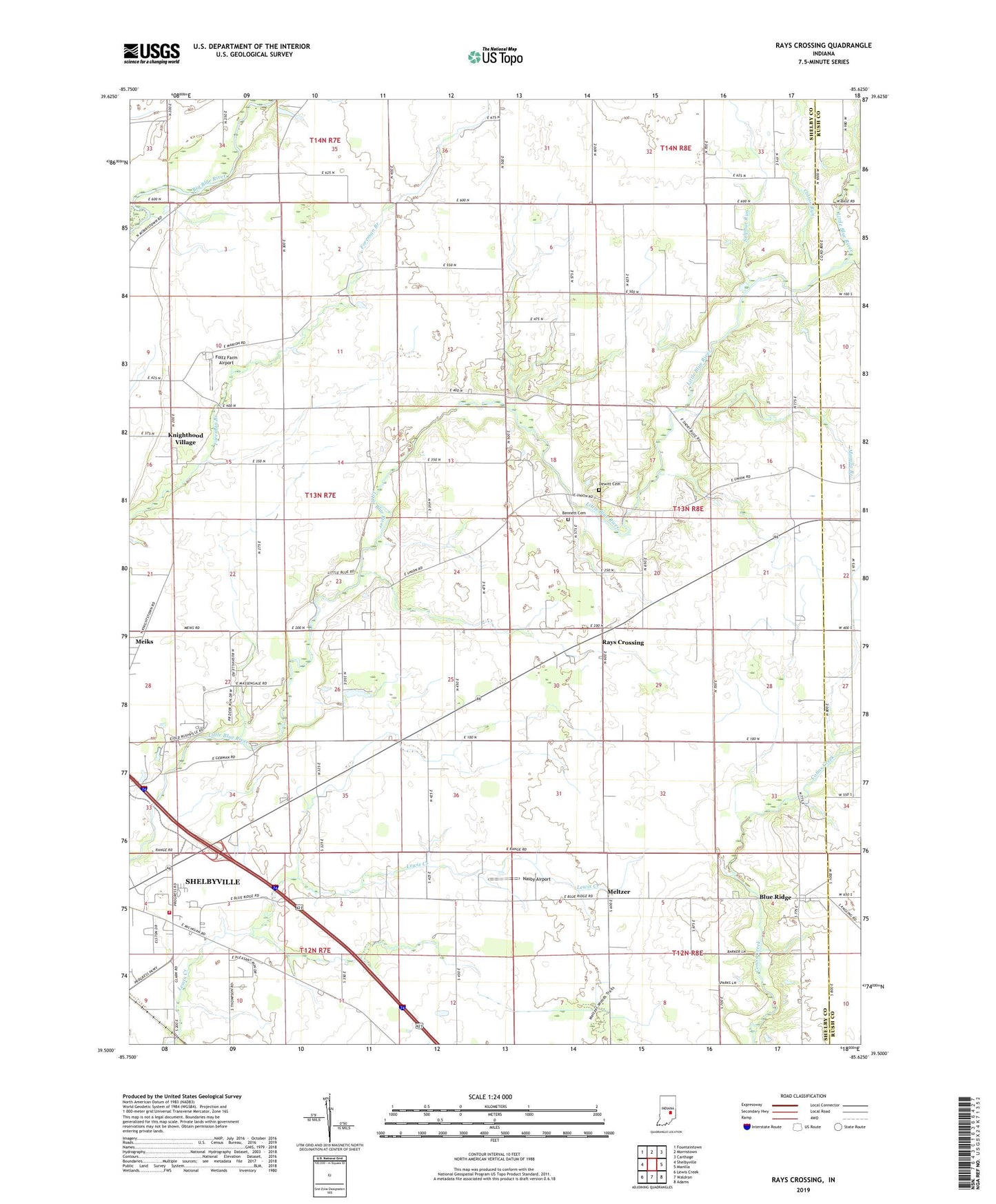
2022 topographic map quadrangle Rays Crossing in the state of Indiana. Scale: 1:24000. Based on the newly updated USGS 7.5' US Topo map series, this map is in the following counties: Shelby, Rush. The map contains contour data, water features, and other items you are used to seeing on USGS maps, but also has updated roads and other features. This is the next generation of topographic maps. Printed on high-quality waterproof paper with UV fade-resistant inks.
Quads adjacent to this one:
West: Shelbyville
Northwest: Fountaintown
North: Morristown
Northeast: Carthage
East: Manilla
Southeast: Adams
South: Waldron
Southwest: Lewis Creek
This map covers the same area as the classic USGS quad with code o39085e6.
Contains the following named places: Bennett Cemetery, Blue Ridge, Blue River Chapel, Cotton Run, Dewitt Cemetery, Foltz Farm Airport, Knighthood Village, Little Blue River Church, Manilla Branch, Meltzer, Mount Pisgah Church, Nasby Airport, Parkinson Airport, Rays Crossing, Shelbyville Fire Department Station 2, Sulphur Run, Township of Union, Zion Church