MyTopo
Center Point Indiana US Topo Map
Couldn't load pickup availability
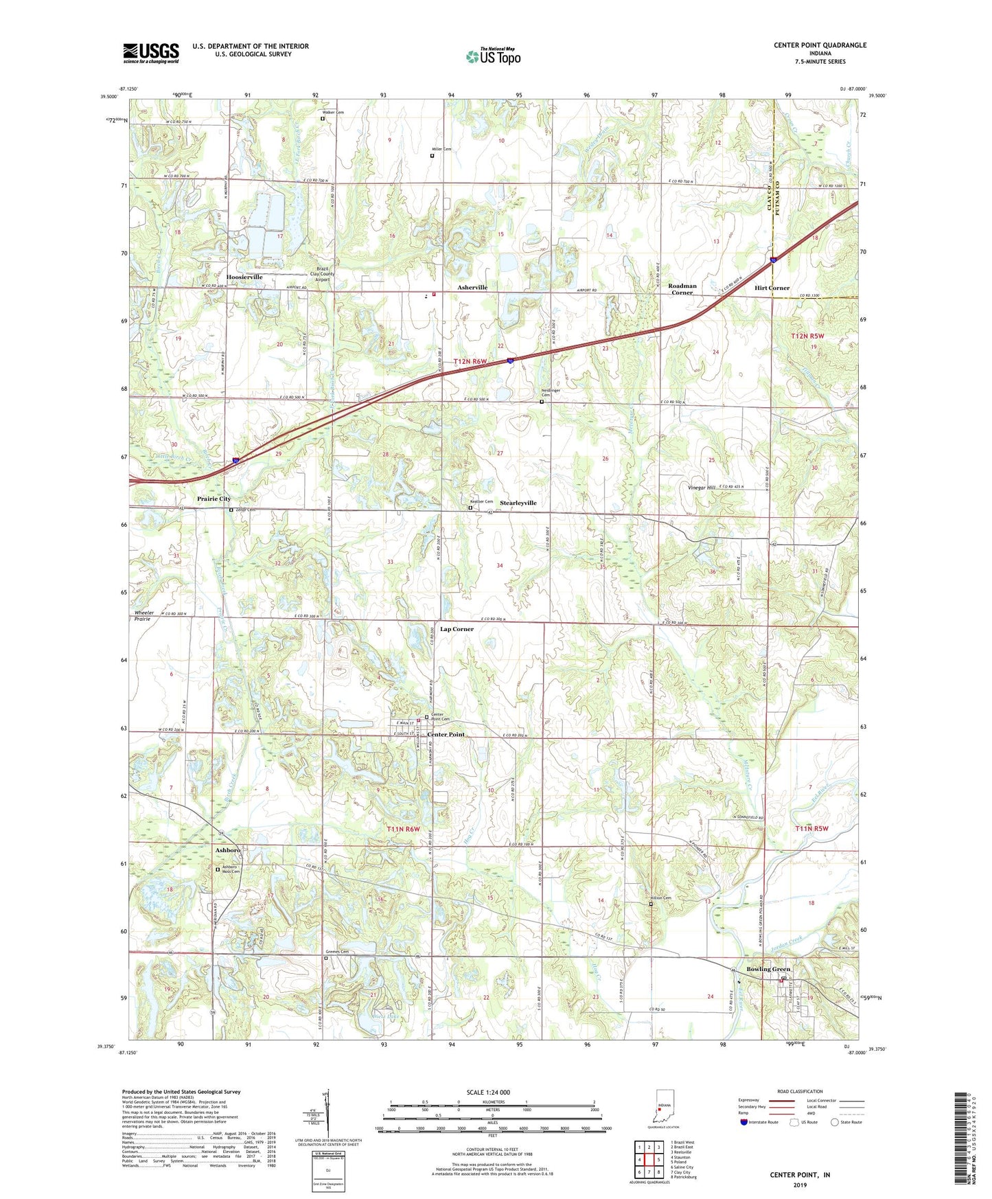
2022 topographic map quadrangle Center Point in the state of Indiana. Scale: 1:24000. Based on the newly updated USGS 7.5' US Topo map series, this map is in the following counties: Clay, Putnam. The map contains contour data, water features, and other items you are used to seeing on USGS maps, but also has updated roads and other features. This is the next generation of topographic maps. Printed on high-quality waterproof paper with UV fade-resistant inks.
Quads adjacent to this one:
West: Staunton
Northwest: Brazil West
North: Brazil East
Northeast: Reelsville
East: Poland
Southeast: Patricksburg
South: Clay City
Southwest: Saline City
This map covers the same area as the classic USGS quad with code o39087d1.
Contains the following named places: Air Evacuation Lifeteam 39, Asbury Church, Ashboro, Ashboro - Moss Cemetery, Ashboro North Pit, Asherville, Bowling Green, Bowling Green Post Office, Bowling Green Volunteer Fire Department, Brazil Clay County Airport, Center Point, Center Point and Community Volunteer Fire Department, Center Point Cemetery, Church Creek, Clay County, Dietz Lake, East Fork Birch Creek, Gremes Cemetery, Hirt Corner, Hoosierville, Jackson Township Elementary School, Jackson Township Volunteer Fire Department Brazil Station, Jordan Creek, Kealber Cemetery, Killion Cemetery, Lake of the Woods, Lap Corner, Little Birch Creek, McIntyre Creek, Miller Cemetery, Miller Creek, Mount Carmel Church, Neidlinger Cemetery, Prairie City, Prairie Creek, Roadman Corner, Saint Johns Church, Son Run, Stearleyville, Town of Center Point, Township of Jackson, Township of Sugar Ridge, Union Church, Vinegar Hill, Walker Cemetery, Zenor Cemetery, ZIP Code: 47840