MyTopo
Patricksburg Indiana US Topo Map
Couldn't load pickup availability
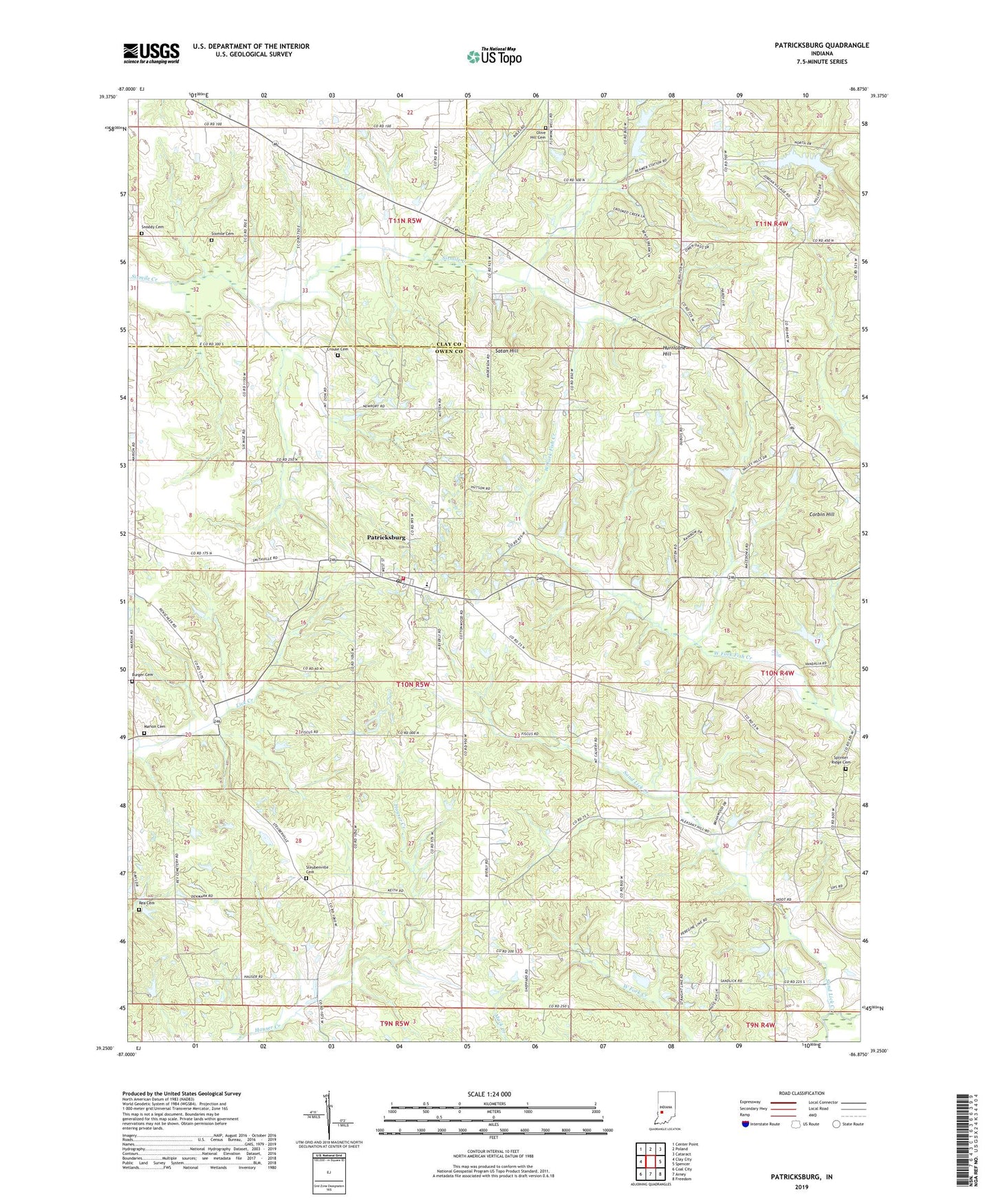
2022 topographic map quadrangle Patricksburg in the state of Indiana. Scale: 1:24000. Based on the newly updated USGS 7.5' US Topo map series, this map is in the following counties: Owen, Clay. The map contains contour data, water features, and other items you are used to seeing on USGS maps, but also has updated roads and other features. This is the next generation of topographic maps. Printed on high-quality waterproof paper with UV fade-resistant inks.
Quads adjacent to this one:
West: Clay City
Northwest: Center Point
North: Poland
Northeast: Cataract
East: Spencer
Southeast: Freedom
South: Arney
Southwest: Coal City
This map covers the same area as the classic USGS quad with code o39086c8.
Contains the following named places: Beamer, Burger Cemetery, Corbin Hill, Crouse Cemetery, Garrard Church, Greybrook Lake, Greybrook Lake Dam, Hoffman Crossing, Hurricane Hill, Marion Cemetery, Marion Mills, Mount Calvary Church, Mount Zion Church, Olive Hill Cemetery, Patricksburg, Patricksburg Community Volunteer Fire Department, Patricksburg Elementary School, Patricksburg Post Office, Pleasant Hill Church, Rea Cemetery, Saint Pauls Church, Sand Lick Creek, Satan Hill, Six Points, Sixmile Cemetery, Snoddy Cemetery, Splinter Ridge Cemetery, Splinter Ridge School, Steubenville Cemetery, Township of Lafayette, Township of Marion, Township of Morgan, ZIP Codes: 47455, 47833