MyTopo
Saline City Indiana US Topo Map
Couldn't load pickup availability
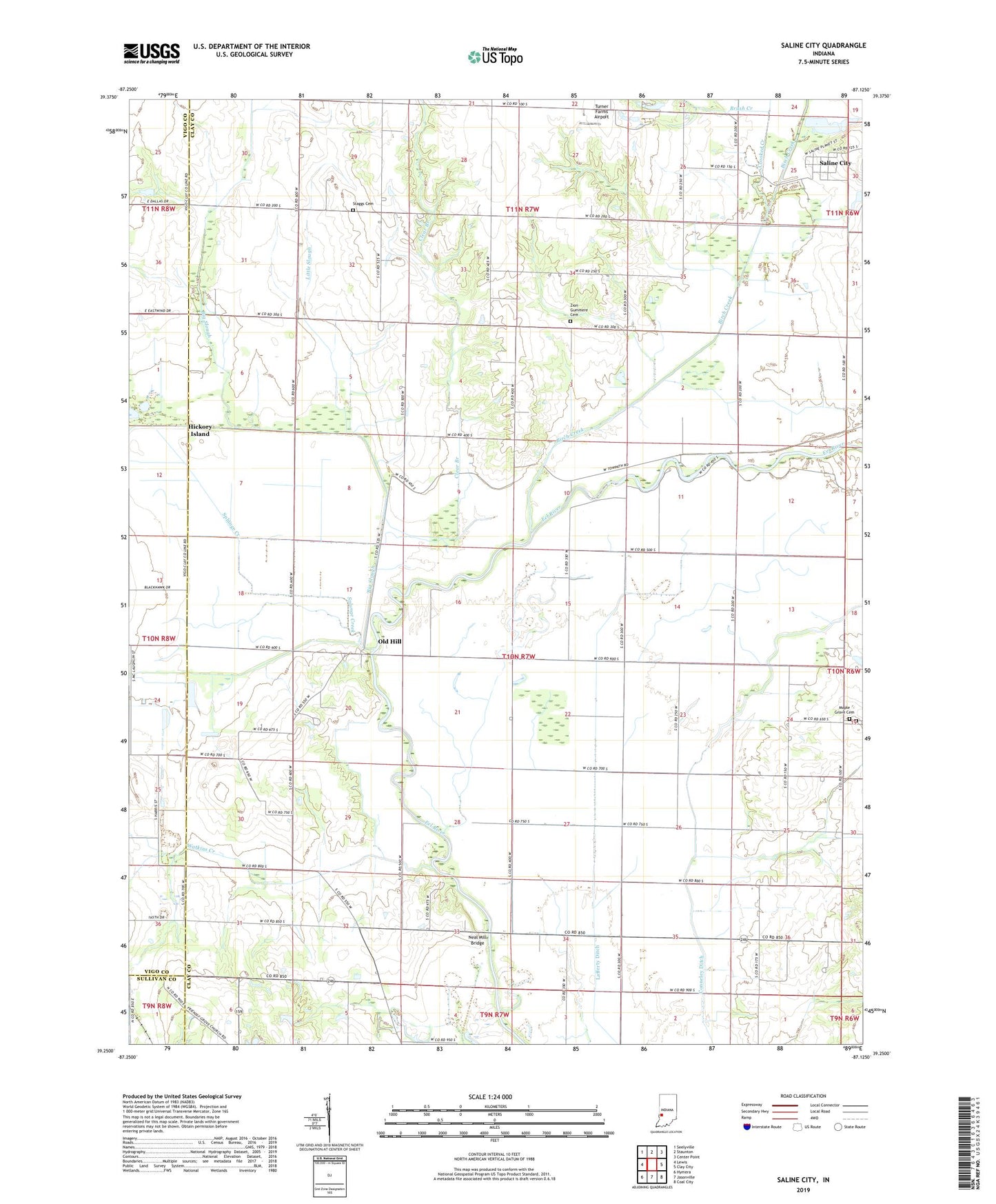
2022 topographic map quadrangle Saline City in the state of Indiana. Scale: 1:24000. Based on the newly updated USGS 7.5' US Topo map series, this map is in the following counties: Clay, Vigo, Sullivan. The map contains contour data, water features, and other items you are used to seeing on USGS maps, but also has updated roads and other features. This is the next generation of topographic maps. Printed on high-quality waterproof paper with UV fade-resistant inks.
Quads adjacent to this one:
West: Lewis
Northwest: Seelyville
North: Staunton
Northeast: Center Point
East: Clay City
Southeast: Coal City
South: Jasonville
Southwest: Hymera
This map covers the same area as the classic USGS quad with code o39087c2.
Contains the following named places: Big Creek, Big Slough, Birch Creek, Briley Chapel, Brush Creek, Clear Branch, Conneley Ditch, Crooked Creek, Hickory Island, Lafferty Ditch, Little Slough, Maple Grove Cemetery, Neal Mill Bridge, Old Hill, Owl Creek, Saline City, Splunge Creek, Staggs Cemetery, Turner Farms Airport, Watkins Creek, Zion Church, Zion Gummere Cemetery, ZIP Code: 47858