MyTopo
Poland Indiana US Topo Map
Couldn't load pickup availability
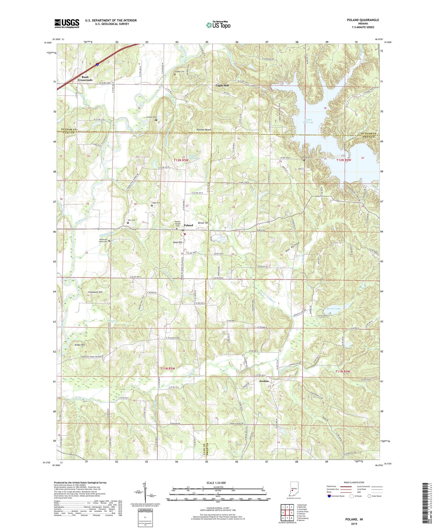
2022 topographic map quadrangle Poland in the state of Indiana. Scale: 1:24000. Based on the newly updated USGS 7.5' US Topo map series, this map is in the following counties: Owen, Clay, Putnam. The map contains contour data, water features, and other items you are used to seeing on USGS maps, but also has updated roads and other features. This is the next generation of topographic maps. Printed on high-quality waterproof paper with UV fade-resistant inks.
Quads adjacent to this one:
West: Center Point
Northwest: Brazil East
North: Reelsville
Northeast: Cloverdale
East: Cataract
Southeast: Spencer
South: Patricksburg
Southwest: Clay City
This map covers the same area as the classic USGS quad with code o39086d8.
Contains the following named places: Ahlemeyer Branch, Barnes Lake, Barnes Lake Dam, Big Walnut Creek, Buck Creek, Cagle Cemetery, Cagle Mill, Cagles Mill Lake, Cagles Mill Lake Dam, Camp Na-Wa-Kwa, Coon Creek, Cromwell Hill, Croys Creek, Drake Hill, Fall Creek, Fertig Cemetery, Grable Cemetery, Greeley Cemetery, Hulman Beach, Jordan, Keiser Hill, King Creek, Knob Creek, Krietenste Camp, Middle Narrows, Mill Creek, Muddy Branch, Nier Cemetery, North Fork Jordan Creek, Oak Grove Church, Owl Hollow, Poland, Poland Chapel Cemetery, Poland Community Volunteer Fire Department, Poland Post Office, Raab Crossroads, Richard Lieber State Park, Sand Hill, Slate Run, Tillman Creek, Township of Cass, Township of Jackson, Township of Washington, Wilkerson - Nees Cemetery, Zion Church, ZIP Code: 47868